ScienceNot yet confirmed elsewhere1 publisher2 min readPublished
Peat fires produce most of Indonesia's haze from under a third of its wildfires
Peat burns in under a third of Indonesia's wildfires but yields most of the haze, according to Greenpeace research. Fire emissions reached 140.5 megatonnes by Oct. 6, the highest since 2019, Copernicus data show.
The Scientist · Science desk
A bar shows 16.4 million of Indonesia's estimated 24.2 million hectares of peatland as degraded and vulnerable to fire, according to the NGO Pantau Gambut.
- Degraded, fire-vulnerable peat, claim 5 16.4 of 24.2 million hectares 68% computed
Degraded, fire-vulnerable peat The whole
| Share | Part | Whole | Percent | Claim |
|---|---|---|---|---|
| Degraded, fire-vulnerable peat | 16.4 million hectares | 24.2 million hectares | 68% (computed) | 5 |
What happened
- Pantau Gambut, an NGO, counts 16.4 million of Indonesia's estimated 24.2 million hectares of peatland as degraded and vulnerable to fire.
- Cultivation drained that land through canal networks spanning about 285,000 kilometers, roughly seven times the circumference of Earth, according to Pantau Gambut research.
- The health ministry said more than 170,000 people in Indonesia needed treatment for acute respiratory infections during August and September.
- In a statement last year, the government said it had rewetted 4.16 million hectares of peatland, built 45,000 canal barriers and replanted native species.
- Last month the government announced a National Peatland and Mangrove Management agency. It replaces an earlier body, whose mandate ran out in 2024.
Why it matters
- exposure Roughly 68% of Indonesia's peatland is already degraded and fire-vulnerable, so most of the country's peat is exposed whenever drought returns.
- constraint Indonesia aims to cut emissions partly by relying on forests, peatlands and other land ecosystems to absorb more than they emit, and peat that burns works against that plan.
- decision Whether concession licenses on peat are revoked and canals blocked now falls to the newly announced peatland agency.
The haze problem starts with how peat forms. It is organic material that did not fully decompose in waterlogged conditions and settled over thousands of years into layers [12]. Plantations for timber, pulp and paper, rice and palm oil are the main culprit in draining it [7]. The water runs off into rivers or the sea, and the dried-out peat is then vulnerable to burning, especially in strong El Nino years that can bring severe drought [8].
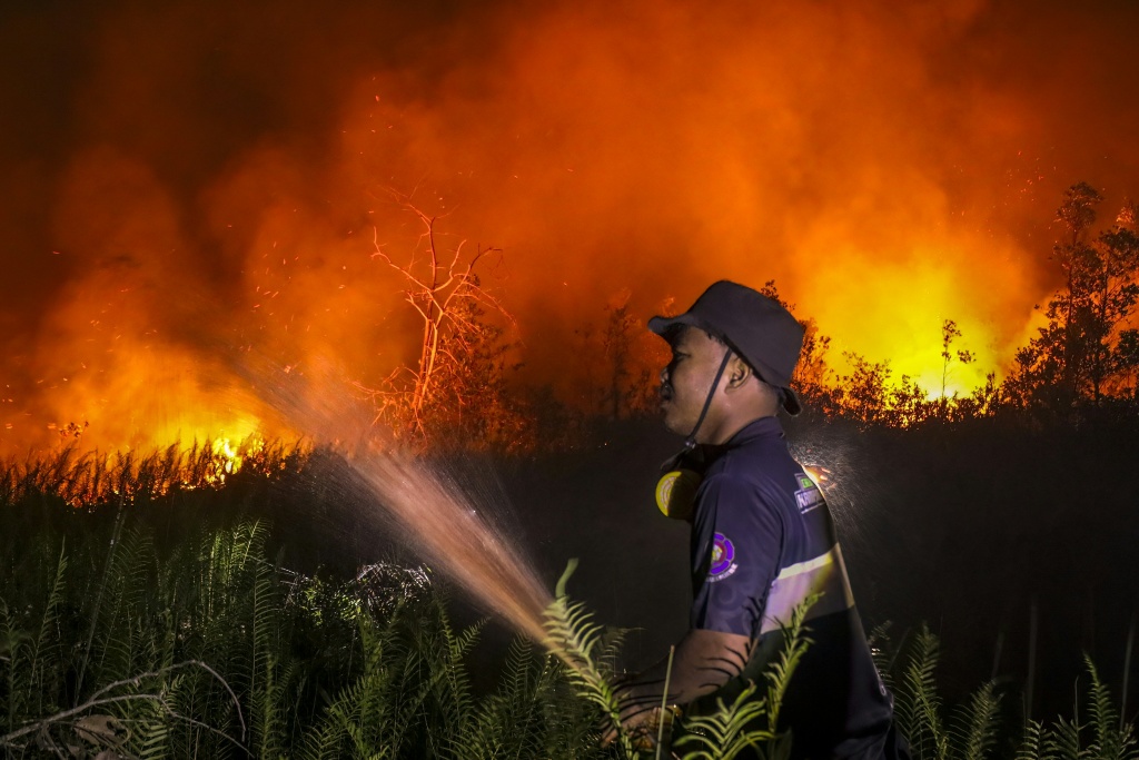
The fires are hard to see. Peat fires burn slowly, mostly under the surface and sometimes for months, and they are responsible for much of this year's dry-season haze [1]. They are often imperceptible but for the foul smoke and the heat underfoot, and the thick carbon layers can keep smoldering in "zombie fires" that are hard to put out [9]. The smoke contains formaldehyde, hydrogen cyanide and ammonia, along with PM2.5 particles fine enough to get into the lungs or the bloodstream [13]. The World Health Organization has tied exposure to PM2.5 to more illness and more deaths [15].
Two carbon figures in the reporting measure different things. Peatlands cover about 3% of global land and store about a third of the world's soil carbon, double what forests hold [10]. That figure measures a global stock [10]. Indonesia has about a third of the world's tropical peatland [11]. The flow is 140.5 megatonnes from Indonesian wildfires by Oct. 6, around 13% of the global total this year [3].
The 140.5 does not separate peat from other fires. The figure covers all Indonesian wildfires [3], and Greenpeace's under-a-third share [2] is a share of fires, not of carbon.
Restoration is harder still to check. The government's rewetting tally equals about a quarter of Pantau Gambut's 16.4 million degraded hectares [22]. One is a government count of work done and the other an NGO estimate of land at risk, so the ratio shows scale only [20][5].
On results, "Today, some of the peat hydrological units that have received major restoration efforts ... have experienced fires and have some of the highest hotspot counts," Belgis Habiba, a Greenpeace forest campaigner, told AFP [21]. High hotspot counts in restored units do not by themselves show the work failed, since units picked for major work may have been the most fire-prone to begin with. The comparison we would want is restored against unrestored units with similar drainage and burn history.
What to watch
- Copernicus year-end totals for Indonesian fire emissions, and whether this year stays the highest since 2019.
- Any published split of Indonesia's fire emissions between peat and non-peat land, or fire outcomes in restored versus unrestored peat units.
- What the new National Peatland and Mangrove Management agency does on concession licenses and canal blocking.
Clarity's read
What the record supports and how the coverage leans. The claims behind it follow.
Reality
- Evidence62
- Adoption
- Insufficient
- Hype gap+5
- Incentives50
- Confidence60
Claim ledger
Ranked by verification strength, evidence, and original report placement.
- [1]
Peatland fires burn slowly, mostly under the surface and sometimes for months on end, and are responsible for much of the dry-season haze that this year has tainted air as far afield as Malaysia, Singapore and the Philippines.
- [2]
Less than a third of wildfires in Indonesia are on peatlands, but they produce most of the haze.
- [3]
By Oct. 6, Indonesian wildfires had emitted 140.5 megatonnes of planet-warming carbon, around 13% of the global total this year.
- [4]
The 140.5 megatonne figure was the highest for Indonesia fire emissions since 2019, another strong El Nino year.
ReportedSupportedSource: Copernicus Atmosphere Monitoring Service, as cited by phys.orgView cited source - [5]
Of Indonesia's estimated 24.2 million hectares of peatland, 16.4 million hectares have been degraded and are vulnerable to fire.
- [6]
Canal networks used to drain peatlands for cultivation in Indonesia span about 285,000 kilometers, seven times the circumference of Earth.
- [7]
The culprit in peatland degradation is mainly industrial-scale plantations for timber, pulp and paper, rice paddies and palm oil.
- [8]
Drainage water runs into rivers or the sea, leaving dried-out peatlands vulnerable to burning, especially in strong El Nino years that can bring severe drought to Indonesia.
- [9]
Peatland fires are often imperceptible but for the foul smoke they emit and the heat they generate underfoot; the thick carbon layers can keep smoldering in 'zombie fires' and are hard to put out.
- [10]
Peatlands cover only about 3% of global land but store about a third of the world's soil carbon, double that trapped by forests.
- [11]
Indonesia has the world's biggest share of tropical peatland, about a third of the global total.
- [12]
Peatlands are composed of organic material that does not completely decompose in waterlogged conditions and has settled over thousands of years into a layered soil-like substance.
- [13]
The haze contains formaldehyde, hydrogen cyanide and ammonia, as well as PM2.5 particles small enough to penetrate the lungs or bloodstream.
- [14]
More than 170,000 people in Indonesia required treatment for acute respiratory infections in August and September.
- [15]
The World Health Organization has linked PM2.5 exposure to increased illness and death.
- [16]
Last month, the government announced the creation of a new National Peatland and Mangrove Management agency to replace a body whose mandate expired in 2024.
- [17]
Activists and experts say concession licenses for extractive activities on peatlands must be revoked, peatlands rewetted and planted with native species, and canals blocked.
- [18]
Indonesia is seeking to reduce its emissions in part by relying on forests, peatlands and other land ecosystems to absorb more than they emit.
- [19]
About 68% of Indonesia's estimated peatland is degraded and vulnerable to fire.
- [20]
In a statement last year, the government said it had rewetted 4.16 million hectares of peatland, built 45,000 canal barriers and replanted various native species.
ReportedContestedSource: Indonesian government statement, as cited by phys.org3 sources— create a free account to open themView cited source - [21]
"Today, some of the peat hydrological units that have received major restoration efforts ... have experienced fires and have some of the highest hotspot counts," Greenpeace forest campaigner Belgis Habiba told AFP.
ReportedContestedSource: Belgis Habiba, Greenpeace forest campaigner, to AFP3 sources— create a free account to open themView cited source - [22]
The government's reported 4.16 million hectares of rewetted peatland equals about 25% of the 16.4 million hectares Pantau Gambut counts as degraded; the figures come from different bodies and are not the same measure.
Sources
1 independent publisher whose own reporting we read for this story.
- phys.orgDamaged and drained, Indonesia's peatlands go up in smoke
1 article · October 13, 2026
Topics and entities
Follow any of these and your For You feed starts watching them — no settings page required.