ProductNot yet confirmed elsewhere1 publisher2 min readPublished
Record El Nino, wrong states: why this winter is noise for Colorado River siting
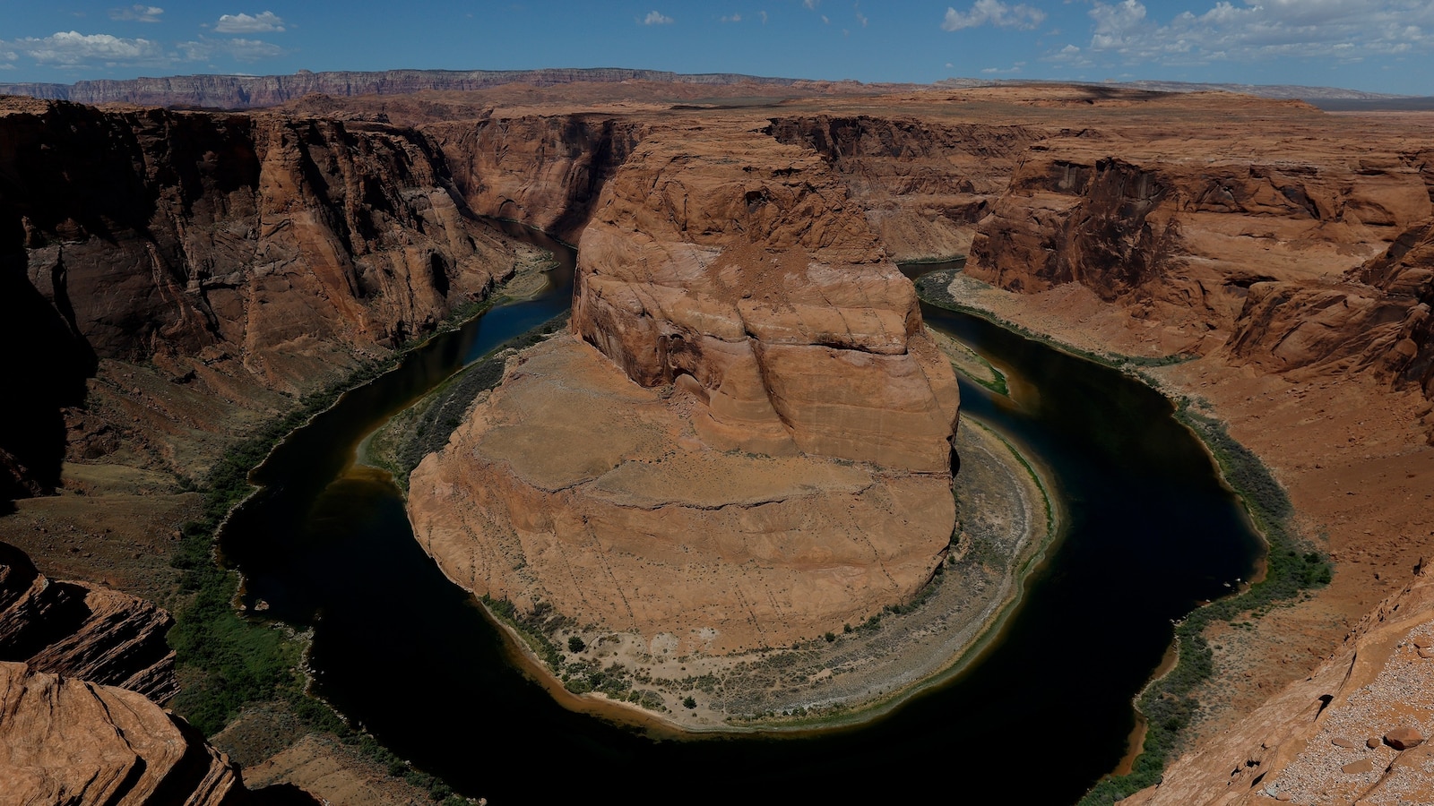
Mead and Powell set multiple record lows this month, and the reliable wet signal lands where the water is used rather than where the snowpack that refills them piles up.
The Product Desk
What happened
- Lakes Mead and Powell, the two largest reservoirs in the country, have each hit multiple record lows this month.
- This year's El Nino is shaping up as the strongest on record and may bring more rain and snow to the southwestern US this winter and spring.
- Every expert quoted expects the Lower Basin to catch the wet weather, which does little to refill Powell and Mead.
- The century-old compact allocating the river expires at the end of this year, with states past several deadlines and the federal government pulled in.
Why it matters
- constraint Rainfall totals in Phoenix or the Imperial Valley are not evidence about supply for a plant sited anywhere in the seven states, because reservoir refill depends on snowmelt from a different set of...
- exposure Anyone buying power off these dams is on a shorter clock than anyone buying the water, since generation degrades before either reservoir reaches the level where deliveries stop.
- decision A good snow year only buys negotiating time, which turns the siting question into whether to commit capital during the reprieve or wait until the allocation is rewritten.
- precedent With the states past multiple deadlines and Washington already involved, the successor rules look more likely to be imposed than agreed, and a commitment made now inherits whatever they say.
The distance to the bottom is easy to compute and easy to over-read. Powell's Thursday reading of 3,519.4 feet leaves 149.4 feet of elevation above the 3,370-foot level where water stops flowing downstream, and Mead's 1,039.6 feet leaves 144.6 feet above its 895-foot equivalent [3][4][18][19]. Those are heads at the dam, not volumes, and there are no storage figures here to convert them with, so the gap is a countdown in feet and nothing more precise than that.
The geography is what decides whether this winter counts for anything. The river is fed primarily by snowmelt out of Colorado, Utah, New Mexico and Wyoming, and that melt is what fills the reservoirs the Lower Basin draws on [8]. Zeke Hausfather of Berkeley Earth describes the reliable El Nino signal as a wet winter across the southern US, "from Southern California through Arizona and New Mexico to the Gulf Coast" [9]. Put the two lists side by side and New Mexico is the only name on both; Colorado, Utah and Wyoming, three of the four snowmelt states, fall outside the band [20].
Where the scientists part company is on whether magnitude changes that answer. Hausfather notes that the last very strong event, in the winter of 2015-16, produced a normal amount of Upper Basin snowfall, and that peer-reviewed correlations between El Nino and Upper Basin snowpack or streamflow are modest at best [10]. Daniel Swain of University of California Agriculture and Natural Resources argues that a normal El Nino and a "ridiculously strong" one are almost two distinct things, which leaves a chance that some Upper Basin states pick up a share of the precipitation [11]. As a planning input, that is an argument from the absence of an analogue rather than from a record of one.
Temperature is doing its own work either way. The past season combined record warm western temperatures, made much more likely by climate change, with some of the lowest snowpack on record, and warmer winters across the West are making snow droughts more common [15][16]. Precipitation that arrives warm is runoff, not storage.
The deficit itself was written on the demand side. The river's water has been over-allocated for decades to thirsty industries including agriculture, and the century-old compact assigning the rights runs out at the end of this year [14][13]. "People have talked about the Colorado River crisis for decades, we're now in it," says John Berggren, a policy manager at Western Resource Advocates [17]. A siting decision underwritten by one winter's snowpack is a bet on weather against an allocation that already promises too much to 40 million people in seven states [1][14].
What to watch
- Upper Basin snowpack readings through spring: whether Colorado, Utah and Wyoming come in above normal or repeat the normal year of 2015-16.
Clarity's read
What the record supports and how the coverage leans. The claims behind it follow.
Reality
- Evidence62
- Adoption
- Insufficient
- Hype gap−8
- Incentives38
- Confidence55
Claim ledger
Ranked by verification strength, evidence, and original report placement.
- [1]
The Colorado River provides water for 40 million people across seven states and is at a crisis point.
- [2]
Lakes Mead and Powell, the two largest reservoirs in the US, have both hit multiple record low points this month.
- [3]
On Thursday, Lake Powell was at 3,519.4 feet and Lake Mead was at 1,039.6 feet, their lowest levels on record.
- [4]
Both reservoirs hit deadpool at certain levels (3,370 feet for Lake Powell, 895 feet for Lake Mead), meaning water can no longer flow out of the reservoirs downstream.
- [5]
Hydropower from dams on both reservoirs will be affected, or go offline entirely, even earlier than deadpool.
- [6]
This El Nino is shaping up to be the strongest of its kind in recorded history and may bring increased rain and snowfall to the southwestern United States this winter and spring.
- [7]
Experts caution that the precipitation might not be enough to stave off the disaster on the Colorado River; even a best-case winter with a healthy snowpack temporarily replenishing the river would be no match for the longer-term problems.
- [8]
The Colorado River is fed primarily by snowmelt from the four Upper Basin states (Colorado, Utah, New Mexico, Wyoming), which then supplies the Lower Basin states (California, Arizona, Nevada) via Lakes Powell and Mead.
- [9]
Zeke Hausfather, climate scientist at Berkeley Earth: "A strong El Nino does load the dice toward a wet winter across the southern US, from Southern California through Arizona and New Mexico to the Gulf Coast."
- [10]
Hausfather says that during the last very strong El Nino, in the winter of 2015-16, the river's Upper Basin experienced a normal amount of snowfall, and that peer-reviewed correlations between El Nino and Upper Basin snowpack or streamflow are modest at best.
- [11]
Daniel Swain, climate scientist at University of California Agriculture and Natural Resources, says a normal El Nino and a "ridiculously strong" one are almost two completely distinct things, and that there is a chance some Upper Basin states could see some of the precipitation.
ReportedSupportedSource: Daniel Swain, UC Agriculture and Natural Resources, quoted by WiredView cited source - [12]
All the experts say the area most likely to be affected is the Lower Basin states, which does not do much to replenish Lake Powell and Lake Mead or help the river's overall supply.
- [13]
A century-old compact dictating water rights from the river runs out at the end of this year; states have missed several deadlines to determine future allocations, requiring the federal government to step in.
- [14]
The river's water has for decades been over-allocated to thirsty industries like agriculture.
- [15]
A winter of record-breaking warm temperatures across the West, made much more likely by climate change, plus some of the lowest snowpack on record in mountain ranges in multiple states, led to an incredibly dry season for the Colorado.
- [16]
Thanks to climate change, many states in the West have seen increasingly warmer winters, making snow droughts more common.
- [17]
John Berggren, a policy manager at Western Resource Advocates: "People have talked about the Colorado River crisis for decades, we're now in it."
ReportedSupportedSource: John Berggren, Western Resource Advocates, quoted by WiredView cited source - [18]
Lake Powell's Thursday level was 149.4 feet above its deadpool elevation.
- [19]
Lake Mead's Thursday level was 144.6 feet above its deadpool elevation.
- [20]
New Mexico is the only one of the four Upper Basin snowmelt states named in Hausfather's reliable wet-signal band; the other three (Colorado, Utah, Wyoming) are outside it.
Sources
1 independent publisher whose own reporting we read for this story.
- wired.comThe Super El Niño Won’t Fix the West’s Water Crisis
1 article · August 21, 2026
Topics and entities
Follow any of these and your For You feed starts watching them — no settings page required.
Topics
Entities
- Colorado RiverFollow
- Lake MeadFollow
- Lake PowellFollow
- El NinoFollow
- Zeke HausfatherFollow
- Daniel SwainFollow
- John BerggrenFollow
- Berkeley EarthFollow
- University of California Agriculture and Natural ResourcesFollow
- Western Resource AdvocatesFollow
- Colorado River CompactFollow