ScienceNot yet confirmed elsewhere1 publisher2 min readPublished
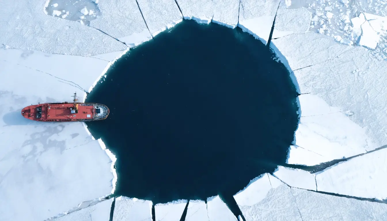
Six atmospheric rivers and upwelling warm water helped open a Portugal-sized hole in Antarctic sea ice
Jeebanjyoti Swain's team says several factors acting together likely opened the Breid Bay polynya, which peaked above 89,000 square kilometers. Earlier work on offshore polynyas has focused almost entirely on the Weddell Sea.
The Scientist · Science desk
What happened
- Through July and August, Breid Bay was struck by six intense atmospheric rivers that raised air temperatures by around 19 degrees C above normal.
- Thick clouds and snowfall acted like a blanket, slowing winter cooling and suppressing ice growth.
- Persistent winds drew warmer water up from deeper in the ocean and created a marine heat wave that stopped the surface from freezing.
- A brief return of colder winds along the polynya's northern edge let new ice form there and enclose the remaining open water.
Why it matters
- capability According to the phys.org account, building these drivers into climate models could make forecasts of Antarctic sea ice more accurate and improve predictions of how its extent changes as the climate warms.
- exposure Open water lets heat and moisture pass freely between ocean and air, and offshore polynyas can strongly influence regional weather, ocean circulation and marine ecosystems, so a new one in a bay that held ice matters beyond the bay.
- precedent Atmospheric rivers had been tied to Weddell Sea polynyas, and the team found them again in a different sector of East Antarctica. Modelers now have a second region to test the same drivers against.
- constraint One polynya against an ice-covered record cannot show how often these drivers line up, so forecasters cannot yet turn the case into a probability.
The team set out to test whether factors linked to Weddell Sea polynyas, including atmospheric rivers, could also explain Breid Bay [12][13]. They tracked daily satellite sea-ice records from 1979 to 2024 and combined them with ship measurements, autonomous floating sensors and reconstructions of the ocean and atmosphere based on observations [6]. Setting winter 2024 against that long baseline let them identify how unusual the season had been [14].
Breid Bay had stayed ice-covered at that time of year since satellite records began in 1979 [2], so there is no earlier August polynya there to compare with, only ordinary winters.
The team concluded that the event was likely triggered by several factors acting together [3]. The phys.org account does not say how much the rivers, the clouds and the ocean heat each contributed. It describes no model run that removes one driver at a time, so there is no test of whether any one of them would have been enough.
We think the study's central claim, that the drivers acted together, is the defensible one. Air and cloud act from above by slowing heat loss, and upwelled water acts from below by adding heat [7][8][9]. A single-cause account would have to explain why the other two were present and did nothing. The polynya peaked on Aug. 4, inside the July-August stretch when the rivers arrived [11][7].
What to watch
- Whether follow-up model experiments remove the atmospheric rivers, the cloud cover and the upwelling one at a time to put a share on each.
- Whether Breid Bay or another offshore site in East Antarctica opens again in a later winter, giving a second event to test the explanation against.
- Whether sea-ice forecast models add terms for cloud, snowfall and ocean upwelling, as the phys.org account suggests they could.
Clarity's read
What the record supports and how the coverage leans. The claims behind it follow.
Reality
- Evidence62
- Adoption
- Insufficient
- Hype gap+10
- Incentives
- Insufficient
- Confidence58
Claim ledger
Ranked by verification strength, evidence, and original report placement.
- [1]
Polynyas are patches of open water surrounded by sea ice, where heat and moisture can pass freely between the ocean and atmosphere.
- [2]
In August 2024 a vast polynya opened in Breid Bay, off the coast of East Antarctica; the region had stayed ice-covered at this time of year ever since satellite records began in 1979.
- [3]
A study in Geophysical Research Letters, led by Jeebanjyoti Swain at Bharathidasan University, India, shows the event was likely triggered by several factors acting together: successive streams of unusually warm, moist air; thick clouds and snowfall that reduced winter cooling; and warmer water rising from the ocean below.
ReportedSupportedSource: phys.org, Sam Jarman, describing Swain et al., Geophysical Research Letters (2026)View cited source - [4]
Most Antarctic polynyas form close to the coast, where strong winds off the continent push sea ice out to sea; polynyas farther offshore are much rarer and can strongly influence regional weather, ocean circulation and marine ecosystems.
- [5]
Until now, studies of offshore polynya events have focused almost entirely on the Weddell Sea.
- [6]
Swain's team tracked daily satellite records of the region's sea ice from 1979 to 2024 and combined them with measurements from ships and autonomous floating sensors, along with reconstructions of the ocean and atmosphere based on real-world observations.
- [7]
Through July and August, Breid Bay was struck by a succession of six intense atmospheric rivers, which brought heat waves that raised air temperatures by around 19 degrees C above normal.
- [8]
Thick clouds and snowfall acted like a blanket, slowing winter cooling and suppressing ice growth.
- [9]
Persistent winds drew warmer water up from deeper in the ocean, creating a marine heat wave that stopped the surface from freezing.
- [10]
A brief return of colder winds along the polynya's northern edge allowed new ice to form there, enclosing the remaining open water.
- [11]
At its peak on Aug. 4, the polynya covered over 89,000 square kilometers (34,000 square miles), roughly the size of Portugal.
- [12]
In the Weddell Sea, offshore polynyas have been linked to a variety of climate and ocean patterns, one of which is the atmospheric river, a long, narrow band of air that carries large amounts of warmth and moisture from lower latitudes toward the poles, weakening sea ice along the way.
- [13]
Swain's team set out to determine whether similar factors could explain the Breid Bay event.
- [14]
By comparing the long-term records with conditions in winter 2024, the team could identify exactly how unusual that season had been.
- [15]
By building these insights into their models, climatologists could make more accurate forecasts of Antarctic sea ice and better predict how its extent will change as Earth's climate warms.
Sources
1 independent publisher whose own reporting we read for this story.
- phys.org'Atmospheric rivers' helped open a Portugal-sized hole in Antarctica's winter sea ice
1 article · October 13, 2026
Topics and entities
Follow any of these and your For You feed starts watching them — no settings page required.