Product2 publishersIndependently confirmed3 min readPublished
NHC warns of Gulf Coast and Florida flooding from AL92 whether or not it becomes a hurricane
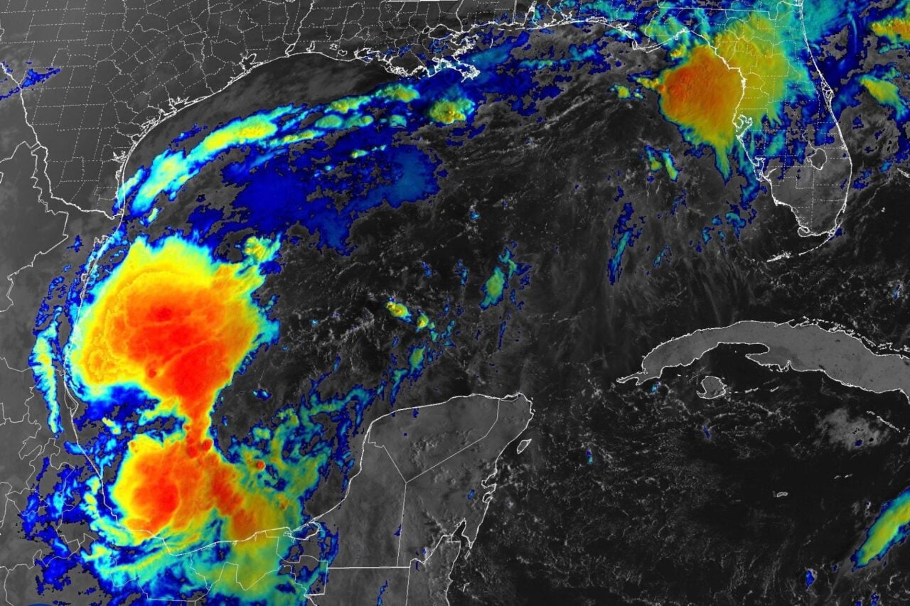
AL92 has a 90% chance of becoming the Atlantic's first hurricane of 2026 within 48 hours, Gizmodo reports. Gulf Coast and Florida operations can start flood prep now and hold closure decisions until the track firms up.
The Product Desk · Product desk
Drafted by a language model from the sources cited here and checked against its claim ledger before publication. How we use AISend a correction
What happened
- Possible landfall points in the forecast models run from Biloxi, Mississippi, east to Seaside on the Florida Panhandle.
- Every ensemble member in the model carries the storm north into the inland Southeast, possibly to Tennessee or Kentucky, before it weakens to post-tropical by Sunday.
- The National Weather Service has posted small craft advisories from eastern Louisiana to northeast Florida, along with scattered flood-related advisories.
- NOAA is advising interests from the Florida Panhandle to Louisiana to closely monitor the system's development.
- The storm would be named Isaias, and reaching hurricane strength after Thursday would break the NWS record for the latest first Atlantic hurricane, October 8, 1905.
Compiled by The Product DeskSomething wrong?How this is made
Why it matters
- decision Flood preparation can start now because the NHC's rain warning applies whether or not AL92 becomes a hurricane. Only closure-type decisions need a firmer track.
- contradiction Gizmodo's 90% figure and Ars Technica's 'decent chance' describe the same storm, and the category range comes from one model. A plan tied to a specific category rests on the least settled part of the forecast.
- constraint Decisions that depend on wind strength get little lead time, because reconnaissance data and clearer forecasts arrive only days before the modeled Thursday-to-Friday peak.
- exposure Sites in the inland Southeast, as far as Tennessee and Kentucky, may be in the storm's path after landfall. A plan that covers only the coast leaves them out.
If you run a warehouse or a field crew on the northern Gulf Coast, the Atlantic has been empty since the season opened on June 1 [18]. Ars Technica counts 2026 as the quietest season to date by most metrics [7]. In the modern record, which goes back to about World War II, no season has gone this late without a hurricane [6].
The comfortable conclusion is that El Niño has the Atlantic covered this year. Some of that is true. El Niño raises vertical wind shear across the basin, and shear makes it harder for cyclones to organize and strengthen [4]. The same El Niño has also been feeding storms in the Pacific. Last week the remnants of Hurricane Polo hit southwestern and central states with heavy rain and flooding [16].
Coverage of AL92 mixes two forecasts, and each needs its own plan. The first is about wind. Gizmodo reports a 90% chance the system becomes a hurricane within 48 hours [2]. Ars Technica gives it "a decent chance" [5]. The intensity range comes from a single model: Google DeepMind's WeatherNext 3 puts maximum sustained winds anywhere from Category 1 to near Category 5 [10]. NOAA has not issued a statement on expected strength [13].
The second forecast is about water, and it holds whatever category the storm reaches. "Regardless of development, heavy rainfall and associated flooding impacts could occur over portions of the northern Gulf Coast, the southeastern United States, and Florida later this week and this weekend," the NHC said [8].
The wind forecast will get firmer soon. According to the NHC, NOAA's Gulfstream was scheduled to sample conditions over the Gulf, and an Air Force reconnaissance aircraft was due to investigate the system the next day [14]. Forecasters expect clearer track and intensity predictions within a couple of days [17]. WeatherNext 3 has the storm peaking between Thursday and Friday [10].
I'd sort the prep list on two tests: whether a step depends on the storm's category, and whether it is cheap to undo. Start with the cheap steps that apply at any category, like flood checks at ground-level sites and a note to staff about how Thursday through Sunday will run. The NHC's rain warning already covers them, so they can happen now. Cheap steps that do depend on category get set up this week and switched on at the next track update. For expensive steps that apply at any category, such as moving weekend freight off routes through the northern Gulf Coast, the call comes midweek. Closing a coastal site between Biloxi and Seaside [11] is expensive and depends on category, so it waits for the reconnaissance data. Inland managers need the same list. Gizmodo reports the storm may reach Tennessee or Kentucky and could still bring major impacts to inland states after it weakens [12].
What to watch
- Air Force reconnaissance readings: winds near the top of WeatherNext 3's Category 1 to near Category 5 range would turn coastal closures from a contingency into the plan.
- Whether the NHC track forecast narrows within the Biloxi-to-Seaside landfall window over the next couple of days.
- Rainfall forecasts for Tennessee and Kentucky as the storm weakens toward post-tropical status by Sunday.