Science1 publisher3 min readPublished
Curiosity drills its 48th Gale crater rock in the newly entered Cache Creek quad
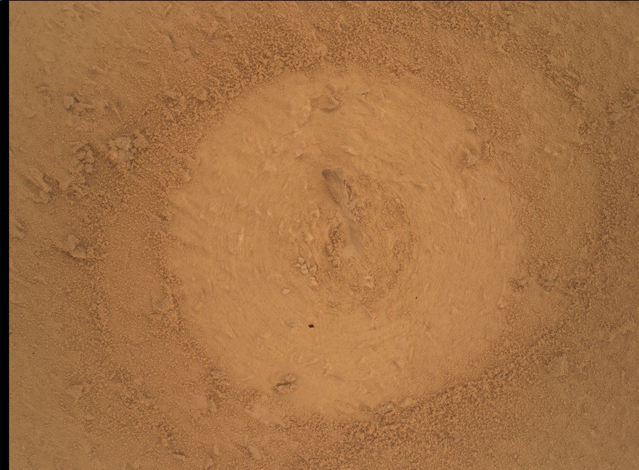
Curiosity has drilled its 48th Gale crater rock, a target called Basque Lakes, in the newly entered Cache Creek quad. A weekend X-ray diffraction run will give the first mineral data on how this rock formed and was later altered.
The Scientist · Science desk
Drafted by a language model from the sources cited here and checked against its claim ledger before publication. How we use AISend a correction
What happened
- Curiosity reached the quad 14 years and 38 kilometers into its trek, with more than a kilometer of climbing, far above the quads the team mapped before landing.
- The quad is named after a geologically varied part of British Columbia whose lakes have unusual chemistry that may resemble lakes that once existed on Mars.
- Sample material goes to SAM next week, and the rover will likely stay about another week before dumping the sample and driving on across Mount Sharp.
Compiled by The ScientistSomething wrong?How this is made
Why it matters
- constraint Until CheMin reports, the only tie between Basque Lakes and the British Columbia lakes is a borrowed place name, so the lake-chemistry comparison stays a hypothesis the mineral data can confirm or drop.
- cost Each drill campaign now holds the rover at one spot for about two weeks, time taken out of the drive up Mount Sharp.
- decision With drilling straining the power budget on an aging rover, the contact chemistry, close-up imaging and pre-load test decide whether a rock gets drilled at all.
- capability Fourteen years in, the rover can still take a new rock from contact triage through drilling to both CheMin and SAM analysis.
Quads are a mapping convention. Before Curiosity landed, the part of Gale crater the team planned to explore was divided into rectangular parcels, each named after a small town associated with significant geological features [1]. Targets inside a quad, whether mesas, bedrock, soil or boulders, get unofficial names on that quad's theme [2]. The rover climbed above the parcels drawn before landing long ago, so Cache Creek lies outside that original set [3][4].
Any link to lake chemistry comes through the name [4]. The British Columbia area it is named for has oceanic crust, marine sediments, volcanic rocks and glacial deposits, plus lakes with unusual chemistry that may be analogous to lakes that once existed on Mars [5]. Lucy Thompson, a senior research scientist at the University of New Brunswick, wrote this week's mission blog [10]. "What gold mine of minerals will the sample contain?" she wrote [9]. Her next question was the comparison itself: "might there be similar minerals present as those associated with some of the lakes in the Cache Creek area of British Columbia?" [8] Her post does not say which minerals those lakes hold.
The decision to drill came out of a triage, and it is a tidy piece of experimental design. Thompson was APXS uplink lead and strategic planner for the week [10]. The team placed the APXS spectrometer on the rock to measure its chemistry, brought the MAHLI camera to within 1 centimeter to examine textures, and had ChemCam fire its laser at the same target [11]. Engineers then ran a pre-load test to check that the rock was stable, and MAHLI imaged it again [12]. Those results fed the call on whether to drill at all [12].
The gate exists for a reason. Drilling and the analyses that follow come with significant power constraints, Thompson wrote, on what she described as an aging rover [13].
Forty-eight drill targets in 14 years works out to about 3.4 a year [1]. The 38-kilometer trek averages about 2.7 kilometers a year, with more than a kilometer of elevation gained along the way [3][2]. A drill stop is long by those standards. Drilling took this week, and Curiosity will likely stay about another week [6][16], so roughly two weeks at one spot [3].
The plan still fit in other work. Mastcam imaged the surrounding terrain for context [14]. ChemCam measured the chemistry of a nearby bedrock target, Peace River, imaged the new drill hole and its tailings, and looked remotely at a deposit of jumbled blocks at the base of a butte called Cordillera [14]. Navcam and Mastcam continued monitoring the crater's environment and atmosphere [17].
I'd count the entry into Cache Creek as new names on the map. The science of the week is the Basque Lakes sample. CheMin's X-ray diffraction analysis was scheduled for the weekend plan drawn up on Friday, Sept. 25, 2026 [7], and delivery of sample material to SAM should follow next week [15]. After that the team expects to dump the sample and drive away to continue exploring Mount Sharp and Gale crater [16].
What to watch
- The CheMin mineral list for Basque Lakes, and whether it includes minerals like those associated with the Cache Creek lakes in British Columbia.
- What SAM finds in the Basque Lakes sample once material is delivered next week.
- Whether power limits on the aging rover start trimming the side observations that accompany each drill campaign.