Science1 publisher2 min readPublished
Twenty named storms by Sept. 28 put the northeastern Pacific well above its 30-year average
NASA counts 20 named storms and nine hurricanes in the northeastern and central Pacific by Sept. 28, against 1991-2020 averages of 13.5 and 7.4. Colorado State data put storm energy at more than double the norm, so the season is running stronger as well as busier.
The Scientist · Science desk
Drafted by a language model from the sources cited here and checked against its claim ledger before publication. How we use AISend a correction
What happened
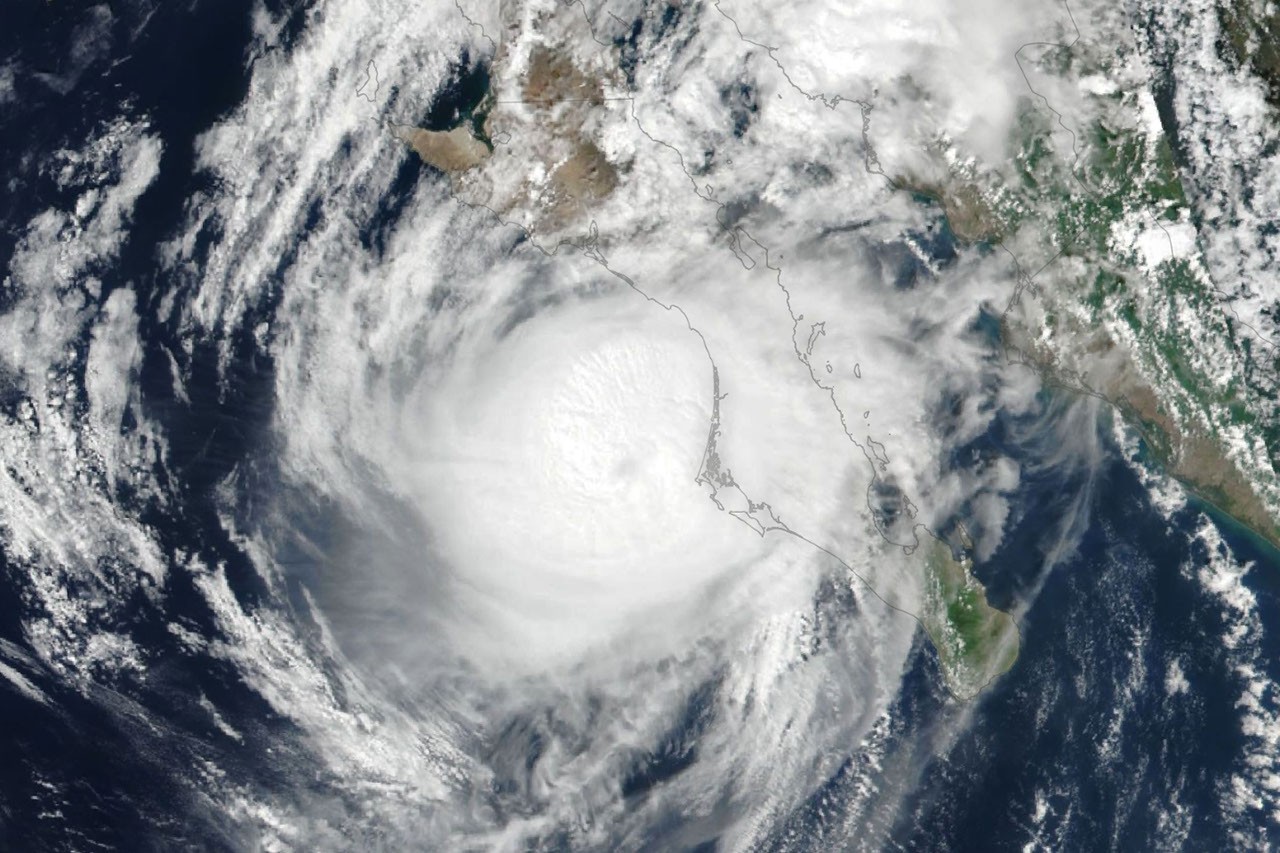
- Hurricane Polo jumped to Category 5 on Sept. 22 after what NASA calls extreme rapid intensification over an unusually warm ocean surface.
- Polo crossed the peninsula and the Gulf of California and made a second, weaker landfall near Guaymas around midday on Sept. 29, with the NHC warning of flooding and mudslides.
- Forecasters expected Polo's remnants, joined by moisture from Post-Tropical Cyclone Odalys, to push heavy rain and flood risk over the U.S. Southwest and southern Plains for several days.
- Hurricane Nolo, the third hurricane this season to pass close to Hawaii, never made landfall but dropped more than 12 inches of rain on parts of Maui and the Island of Hawaii.
Compiled by The ScientistSomething wrong?How this is made
Why it matters
- decision A planner who tracks storm counts would underrate this season, because the added energy is concentrated in individual storms more than in their number.
- constraint Because the surplus coincides with El Niño, this year's figures alone are a weak basis for revising long-range coastal design assumptions.
- exposure Hawaii's hazard this year has come from hurricanes passing close, so response plans keyed to landfall miss much of the flood and landslide risk.
Twenty named storms against an average of 13.5 for the date is about 48% above normal [1]. Nine hurricanes against 7.4 is about 22% above [2]. Of the roughly 6.5 storms above the average, only about 1.6 are hurricanes [6]. By count, then, most of the surplus is storms that never reached hurricane strength: 45% of this year's named storms became hurricanes, against roughly 55% in the average season [3].
Colorado State's energy figure is up far more than the count. Accumulated cyclone energy in the Northeast Pacific was more than twice the norm as of Sept. 28 [3]. With the storm count up by only about half, each named storm is carrying at least a third more energy than the norm would imply [4]. The NASA account does not say whether Colorado State's norm covers the same years and waters as the storm-count average, so treat the per-storm figure as approximate.
NASA's account links the activity to El Niño, which has been under way since June and is expected to raise tropical cyclone activity in this basin [4]. Warm water in the equatorial Pacific and low wind shear, both typical of El Niño, encourage storms to form and then strengthen [5]. Those two effects match the two numbers above: more storms, and more energy in each [4]. The thing a single season set against a 30-year mean doesn't tell you is how much of the surplus belongs to this El Niño and how much to anything slower-moving.
Polo's Category 5 peak and its first landfall were about six days apart [5]. When it reached Baja California Sur around 11 p.m. local time on Sept. 28, the National Hurricane Center judged it likely a Category 2 [7]. The hazards that reached people, at both landfalls and in the rain forecast for the Southwest, came from a storm already well past its peak. I think the energy data and Polo's jump together justify planning for strong storms in this basin for the rest of the season. Polo's own peak, though, came days from shore [5].
Hawaii's damage also came from a storm that stayed offshore. Nolo's rain flooded roads, toppled trees and triggered landslides, according to news reports NASA cited [11]. The Island of Hawaii was still spared some of the more severe effects Hurricane Lala brought in mid-August [12].
What to watch
- Colorado State's end-of-season accumulated cyclone energy for the Northeast Pacific, and whether energy per storm stays well above the norm as the count grows.
- Rainfall and flood reports from the U.S. Southwest and southern Plains as Polo's remnants and Odalys's moisture move through.
- Whether El Niño holds through the rest of the Pacific season, since NASA ties the busier basin to its warm water and low wind shear.