Product1 publisher3 min readPublished
DeepMind's extra day of hurricane warning rests on three years of historical storms
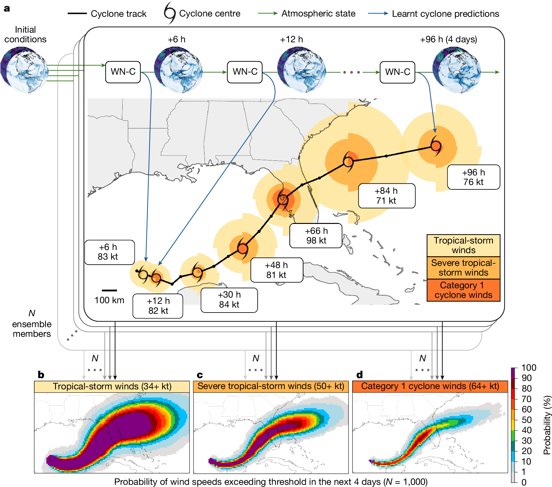
Google DeepMind's WeatherNext Cyclones gives hurricane forecasters about an extra day of accuracy on average, according to a Nature study of past storms. So far it has one live season on record, and that season is what forecasters will lean on when the next storm strengthens fast.
The Product Desk · Product desk
What happened
- WeatherNext Cyclones went into operational use for the first time during the 2025 Atlantic hurricane season.
- In that season it helped the National Hurricane Center call Hurricane Melissa's rapid intensification and Jamaica landfall with about 80% confidence five days out and near 100% three days out.
- The Nature study reports state-of-the-art accuracy for the model on cyclone track, intensity and wind structure.
- The researchers say the gain is roughly equal to a decade of progress in traditional hurricane forecasting.
Compiled by The Product DeskSomething wrong?How this is made
Why it matters
- decision Forecasters deciding how far to trust the model on any one storm have a three-year average plus a single live season to go on, and the average does not show which storms produced it.
- capability Forecasters can now get track and intensity guidance from one model, a pair that opposing physical scales have long stopped physics and AI models alike from predicting well together.
- constraint Live evidence on rapid intensifiers, the Otis-type storms that catch coastlines unprepared, rests largely on Melissa, the one operational case the published account details.
Forecasters tracking Hurricane Otis in 2023 were working from physical models that failed to predict its jump from tropical storm to Category 5 [13]. Communities on Mexico's Pacific coast were unprepared when it made landfall, and the storm killed dozens [13]. AI models were no help at the time. "AI was even worse than physics-based models at predicting intensity, and it was also not believed to be good at extremes," said Ferran Alet, a staff research scientist manager at DeepMind [14].
The one-day figure comes from a retrospective test. DeepMind worked with experts at the National Hurricane Center and other institutions to run WeatherNext Cyclones on historical data from 2023 to 2025, and the extra day is an average across that set [8]. The window covers three years and includes 2025, the same season the model ran live [1].
Forecasters rely on a variety of models, and in recent years they have added several AI ones to the set [3]. Gizmodo says AI models have become "highly competitive with even state-of-the-art physical models," and that after the 2025 Atlantic season "one clearly stood out" [4].
Intensity was the hard problem for both camps. Global atmospheric currents steer a cyclone, while fine-scale thermodynamic processes near its center drive its strength, and models have long struggled to predict both at once [12]. DeepMind's first WeatherNext model was a general forecaster. Alet said "we were initially just trying to forecast everyday weather, so we trained an AI model that, given the weather today, predicts the weather tomorrow" [10]. It was very good on tracks and struggled with intensity [11]. The fix, research scientist Tom Andersson said, came from "specializing our models to train on an expert database of historical tropical cyclones" [15].
Andersson said the internal tests had not convinced the team either. "We had evaluated our model internally on historical forecasts, and we're very rigorous with our evaluations. But even then, we didn't know if we could really believe what we were seeing," he said [16]. On live data the model had never seen, he said, the team was "frankly shocked by the performance" [17]. These are the developer's words, given to Gizmodo for the write-up that named the model a winner of its 2026 Science Fair [1].
A team deciding how much weight to give a model like this can sort its evidence on two axes: backtest or live run, and average storm or rapid intensifier. The extra day belongs in the backtest, average-storm box [8]. Melissa belongs in the live, rapid-intensifier box, where confidence rose about 20 percentage points between five days and three days before landfall [2]. Gizmodo's account does not break out backtest results for rapid intensifiers alone, and the live, average-storm box holds a single season [5]. Rapid intensifiers like Otis are the storms forecasters most need the model to get right. Projections cited by Gizmodo expect bouts of rapid intensification to rise with warming, and average cyclone intensity to climb 1% to 10% globally at 2 degrees Celsius [18].
What to watch
- NHC verification of the 2026 season comparing WeatherNext Cyclones with physics-based guidance on rapid-intensification storms.
- A storm-by-storm breakdown of the Nature results showing whether the one-day average holds for rapid intensifiers or comes mostly from ordinary storms.