Science1 publisher2 min readPublished
Four days of late-monsoon rain sent the Gandak River to record levels in Nepal and India
Late-monsoon storms pushed Nepal's Gandak River to 11.94 meters at Devghat on September 27, its highest since gauging began in the 1960s. Embankments were overtopped and breached in several places as water spread over farmland and towns for hundreds of kilometers.
The Scientist · Science desk
What happened
- News reports cited by NASA said four gauges on the Indian stretch of the river, at Bagaha, Dumariaghat, Rewaghat and Lalganj, also set new high-water marks.
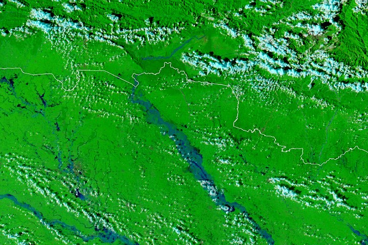
- MODIS instruments on NASA's Terra and Aqua satellites photographed the river on September 20 and again on September 29 to map how far the water spread.
- According to news reports, flooding and landslides affected hundreds of villages and displaced thousands of people.
- The Times of India reported on October 1 that two more embankments had given way in Saran and Muzaffarpur, and that the Indian Air Force had joined relief work.
Compiled by The ScientistSomething wrong?How this is made
Why it matters
- decision Any embankment height planned from the Devghat record as it stood before September is now below a level the river has actually reached, so re-rating the Gandak's defences starts from a higher baseline.
- constraint A flooded-area figure read off the satellite images counts water on in-channel diara fields alongside water behind failed embankments, so on its own it cannot measure how the defences performed.
- constraint Breaches were still being reported after the September 29 frame, so the extent that image maps is a lower bound on how far the flood eventually reached.
The two frames make a simple before-and-after test. The first was taken four days before the rain began [1] and the second two days after the Devghat gauge peaked [2]. Any new water in the second frame therefore arrived in a window containing the September 24 to 27 storms over Lumbini and Gandaki provinces [1]. Both frames use MODIS bands 7-2-1, a false-color mix of infrared and visible light in which floodwater shows blue and vegetation bright green [5].
The control does not sort the water by cause. In many areas the new blue sits on diara, seasonal fields on low-lying sand and silt inside the river's channel, where flooding is expected [6]. The evidence of defences giving way covers a smaller area: water broke through embankments into settled places, including parts of Bagaha, Areraj and Fulia Khand [7].
I think the evidence supports a narrower finding than a general verdict on the Gandak's flood defences. The embankments gave way to a flood that set records on both sides of the border [2], with Devghat higher than at any point in roughly six decades of measurement [3]. NASA's account says the water both overtopped and breached embankments [3]. Those are different failures. The account does not say which happened where, what heights the embankments were built to, how much rain fell, or whether the storms' late arrival in the monsoon [2] played any part.
A flood that beat the gauge record and got past the embankments fits two explanations. The defences may have been built too low, or the flood may have exceeded anything they were designed for. Telling them apart needs rainfall totals set against the river's response, plus reports on whether each breach came over the crest or through the structure. NASA lists its GPM IMERG Global Viewer, with Worldview and FLOOD Viewer, among its tools for tracking rainfall and flooding [11].
What to watch
- GPM IMERG rainfall totals for Lumbini and Gandaki provinces over September 24 to 27, to test whether the rain itself or the river's response was the outlier.
- Bihar breach surveys stating whether each failed embankment was overtopped or broke below its crest.
- A MODIS frame from after the October 1 breach reports, showing how far water spread beyond the September 29 extent.