Science1 publisher3 min readPublished
Shatter cones confirm a 25-kilometre Quebec crater that earlier surveys called volcanic
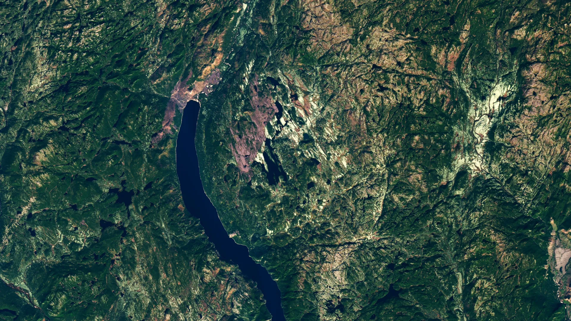
Joel Lapointe noticed a circle near Lake Marsal while planning a 2024 camping trip in Quebec. A floatplane and a 50-metre wade later, Gordon Osinski's team found the shatter cones that decided its origin.
The Scientist · Science desk
What happened
- In 2024 an amateur astronomer, Joel Lapointe, spotted a circular feature near Lake Marsal on online satellite imagery while planning a camping trip in Quebec's remote Cote-Nord region.
- His inquiry helped prompt French researchers to present the lake area at a 2024 Meteoritical Society meeting as the centre of a potential 11th known impact structure in Quebec.
- Gordon Osinski of Western University, who directs the Impact Earth database, was skeptical at first but organized an expedition to the site in October 2025.
- By the second day the team had found shatter cones in numerous outcrops, evidence that forms only under impact pressures and that overturned the earlier volcanic interpretation of the rocks.
Compiled by The ScientistSomething wrong?How this is made
Why it matters
- constraint Public imagery can generate candidate circles cheaply, but the diagnostic that confirms one has to be seen on the outcrop, so expedition logistics set the rate at which the catalogue actually grows.
- contradiction These rocks had already been examined and assigned a volcanic origin, so part of the gap between 200 confirmed structures and the hundreds suspected is probably misclassification.
- precedent An unsolicited note from an amateur to specialists ended in a conference abstract and then a funded field trip.
- decision The confirmed count does not move until a Meteoritical Society committee rules at its next meeting, so the team's position and the official tally are separate things for now.
A shatter cone is the one field observation that closes the question. The structures form under the intense pressures produced during an impact, and their presence in the outcrops is what argued against a volcanic origin [10]. "It's the only unequivocal evidence of an impact event that you can see in the field with the naked eye," Osinski said in an account published by NASA Earth Observatory on September 22, 2026 [11][22].
The imagery found a circle; it could not separate the two candidate origins. Earlier geological surveys had interpreted the local breccia as a diatreme, the funnel-shaped pipe of shattered rock left when explosive magma eruptions blow through [9]. Someone had to go and look.
Going was hard. The floatplane could not reach shore, so the team waded 50 metres carrying its equipment [6]. The ground was rugged and swampy, with what Osinski called "deep, twisty, gnarly vegetation" [7], and he said that across years of fieldwork on six continents the area ranked among the most difficult environments he had ever worked in [8].
The structure itself is complex: about 25 kilometres across, with a central uplift and high cliffs showing columnar jointing [12]. That makes it the largest impact crater found since the 31-kilometre Hiawatha structure in 2018, about six kilometres smaller across than Hiawatha [17][21]. A comparable strike on modern Quebec, Osinski said, would cause "regional devastation on a scale that would wipe out major cities and have global climate impacts" [13].
Earth has about 200 confirmed impact structures, and geologists think hundreds more are still unidentified [1]. Uhackatik, the name the researchers adopted after discussions with the Innu Council of Ekuanitshit [15], would be Quebec's eleventh [4]. One province would then hold roughly one in eighteen of the world's confirmed craters [19]. Quebec may have been struck more often, or its old exposed bedrock may simply make old craters easier to see.
The samples put the impact at roughly 390 million years ago, about 100 million years before a rise in cratering that researchers have suggested may be linked to collisions in the asteroid belt [14]. Subtract, and that rise sits near 290 million years ago [20].
In my view the imagery half of this search is now open to anyone with a browser and the confirming half is not, so the list of candidate circles will grow faster than the list of confirmed craters. Access is the binding limit, and it binds even for people whose job is visiting craters: Osinski is part of NASA's first Artemis Geology Team and helps train astronauts in geology, and he does not expect Uhackatik to become a training site because reaching it is so difficult [18].
What to watch
- A peer-reviewed age for the structure with stated uncertainty around the 390-million-year estimate.
- Whether the Impact Earth database, which Osinski directs, lists Uhackatik before the society rules on it.
- Whether the 25-kilometre diameter holds once the structure is mapped in more detail than one expedition allowed.