Science2 publishers3 min readPublished
Attribution report links Nepal's deadly slope collapse to a freezing line rising 100 metres a decade
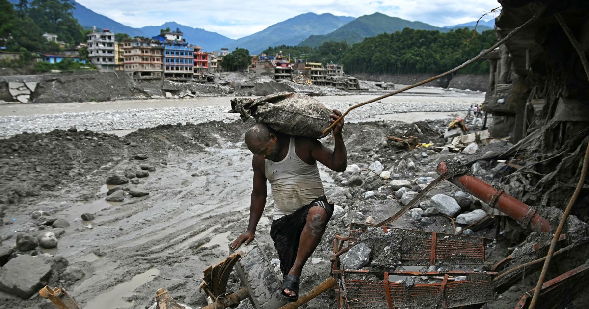
The World Weather Attribution analysis of the August 26 collapse that killed more than 1,300 people finds thinning glaciers and thawing permafrost weakened the slope over decades, without saying warming caused the failure.
The Scientist · Science desk
What happened
- A World Weather Attribution report released Thursday found that human-caused warming thinned glaciers and thawed mountain permafrost, likely helping to destabilise the Himalayan slope that collapsed last month.
- More than 1,300 people were killed and over 5,000 remain missing after rock and overlying glacier fell near the Chinese border and swept the Trishuli River corridor, causing billions of dollars in damage.
- The researchers concluded that warming intensified several processes that made the slope less stable over decades, without determining whether the collapse would have happened without climate change.
- The weeks before the August 26 failure were unusually warm, with July and August 2026 the warmest such months recorded locally, according to the analysis.
- Nature reported that satellite imagery captured the collapse and is now informing recovery operations.
Compiled by The ScientistSomething wrong?How this is made
Why it matters
- constraint Around 78% of the region's glacier area sits in the 4,500 to 6,000 metre band, an elevation highly exposed to warming. The findings point hazard mapping at that entire band, and ranking one slope against another is beyond them.
- decision A freezing line moving up roughly 100 metres a decade means the historical record understates the hazard for anything already built below a deglaciating wall. That understatement pushes the choice toward relocation.
- contradiction The two accounts do not agree on the toll or the valley: Nature puts the dead above 1,000 in the Bhotekoshi valley, while the attribution report counts more than 1,300 along the Trishuli corridor.
- precedent Publishing a slope-failure attribution in the month after the event sets an expectation that geophysical disasters, not only heatwaves and storms, get studied on the timescale of the emergency response.
Permafrost is part of what holds fractured high-mountain rock together, and rising temperatures across the Himalayas are thawing it while the glaciers above retreat [15]. The altitude at which ground stays frozen year round has climbed by roughly 100 metres a decade. Rock at ever higher elevations now sits through long spells above freezing, the ice inside its cracks thaws and the face beneath weakens [7]. Jakob Steiner, a geoscientist at the University of Graz, has worked in the region since 2006 and did not write the report. He said monitoring instruments at around 5,000 metres now show rock and ground that no longer stay frozen through the year [8]. "This means that the ground that was sitting below ice for hundreds and thousands of years is now becoming exposed," said Steiner [9].
Ice loss works on the same rock from a different direction. Glaciers in the region have been losing mass for decades at a rate equal to more than half a metre of thinning each year [10]. As they shrink they remove the pressure that braced adjoining rock walls, and they produce extra meltwater [12]. The Langtang Lirung glacier, in the region where the slope failed, has retreated about half a kilometre since the 1990s [11]. Run the two published rates across those same three decades and you get about 300 metres of upward shift in the freezing line and more than 15 metres of ice thinned off the surface [1][2]. United Nations reports put glacier losses between 2000 and 2019 at 267 billion tons of ice a year [18].
The analysis stops short of a counterfactual, and the authors flagged a second cause: the large 2015 Nepal earthquake may have weakened the rock years before the collapse [2]. "This disaster was not an extreme weather event, but the fingerprints of climate change are still clear to see in long-term changes," said Ben Clarke, a climate researcher at Imperial College London who worked on the analysis [3]. Friederike Otto, a climate scientist at the same institution, is one of the report's authors. She said that "other than the potential geological factors like earthquakes that are weakening the bedrock, all these other factors are made worse by human-induced climate change" [14].
Communities in this stretch of the Himalayas are concentrated in narrow river valleys below walls that are losing both their ice cover and their frozen binding [22]. The published rates apply to all of those walls at once. In my view that is enough to justify siting rules and hazard maps that treat the whole elevation band as trending, and not enough to tell a district engineer which valley to clear first.
Nature, reporting on the same event, framed the consequential question as whether comparable signals were detectable before 26 August and, if they were, whether they reached anyone positioned to act on them [21].
What to watch
- Whether the World Weather Attribution team or others publish a counterfactual estimate for the probability of this slope failing without warming.
- Whether Nepali agencies release pre-collapse satellite or instrument records that show detectable precursors above the Trishuli corridor.
- Whether the dead and missing counts converge as recovery work continues.