Invest1 distinct publisher3 min readPublished
The flood along the Nepal-China border came out of ice and rock rather than rain, and the same researchers who count 95,000 Asian glaciers expect up to three quarters of them gone by 2100, which makes this a siting question well before it is a climate one.
The Investor · Invest desk

Compiled by The InvestorSomething wrong?How this is made
The two headline figures come from two different mouths, and multiplying them anyway is instructive. About 95,000 glaciers across Asia's mountain ranges, covering an area roughly the size of South Korea, is Dan McGrath of Colorado State University's count as relayed by CNN [2]; up to 75% of high mountain Asia's glaciers disappearing by 2100 is the projection Jason Gulley cited in the New York Times [9]. Put them together and roughly 71,000 sit on the vanishing side of the ledger with about 24,000 left [1], which spread across the 75 years to 2100 is near 950 a year [2], or rather, since a glacier's disappearance is not the loss event, 950 chances a year for meltwater to pool behind whatever rock and sediment happens to lie downhill [8]. The two numbers almost certainly do not share a denominator, a count of glaciers being a different thing from a share of ice area or volume, so the arithmetic is an order of magnitude and not a schedule [1].
The figure that should actually reach an underwriting file is smaller and far more local. Gulley's Khumbu site was little more than a pool when he first visited in 2005 and measured about 229 metres by 259 metres when he came back in 2025 [10], which is around 59,000 square metres of new water surface, call it 5.9 hectares [3], arriving at an average of roughly 2,900 square metres a year [4]. Depth is not in the reporting, and depth times area times the geometry of the moraine holding it is the entire loss estimate, so what this gives you is a direction of travel rather than an exposure.
The most quotable number here is the one you cannot model with: the annual melt volume likened to the height of the Empire State Building, about 381 metres [4]. That figure describes a height, not a volume, and it is not something anyone can reserve against.
The view I would defend is that this sits in the siting and route decision rather than the climate appendix, because the interval that carries information is the 20 years of observed lake growth [10], not the 2100 horizon [9], and 20 years fits inside the life of a bridge, a highway section or a run-of-river plant. That reading holds up against two objections. First, outburst risk is intensely local, a function of one lake and one dam above one valley [8], so a portfolio-wide reprice would be attention spent where the hazard is not, and the honest unit of analysis is the valley. Second, the trigger itself is still open: CNN's satellite and ground imagery point to part of a glacier breaking away and driving a landslide of water, rock, ice and debris into the rivers [5], but scientists say more work is needed before anyone assigns the event a climate share [6], and if attribution lands on rock-slope failure the peril gets a different name and a different pricing desk.
Someone pays for the monitoring the researchers are asking for [11], and on current arrangements it is whoever owns the thing standing downstream.
Ranked by verification strength, evidence, and original report placement.
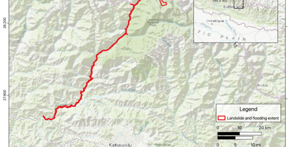
Glacier collapse and landslides have been identified as the cause of massive flooding along the Nepal-China border, and experts warn similar disasters could recur as glaciers melt rapidly across Asia's high mountain regions.
CNN reported, based on satellite imagery and footage from the site, that part of a glacier broke away from a mountain and triggered a massive landslide, sending large volumes of water, rock, ice and debris into rivers.
Jason Gulley, a professor of geology at the University of South Florida who studies glacial hydrology in Nepal and has made repeated expeditions to the Himalayan region over the past two decades, warned in a New York Times opinion piece on the 28th that lakes formed by melting glaciers could create new flood risks for downstream areas.
According to Gulley, continued warming melts high-altitude glaciers and the water can pool into lakes when blocked by surrounding rock and sediment; if the natural dam gives way once the lake is large enough, the water can be released all at once, causing severe damage downstream.
Gulley said that when he first visited Nepal's Khumbu region in 2005 one site was little more than a small pool of water, and that when he returned in 2025 the lake had grown to about 750 feet (229 metres) wide and 850 feet (259 metres) long.
Experts say monitoring and preparation are needed for compound disasters such as glacier collapses and glacial lake outburst floods as warming reshapes glaciers and high-altitude terrain.
Distinct publishers with included, body-backed reporting in this cluster.
en.sedaily.com
1 article · August 29, 2026
Follow any of these and your For You feed starts watching them — no settings page required.
leadership
OpenAI writes the Pentagon's looser human-control standard into its own policy1 distinct publisher
product
Cinemas, classrooms and ICE: smart glasses now need a venue-policy contingency1 distinct publisher
product
From Omaha students to ICE: the shock glove sold as camera-proof force1 distinct publisher
product
Harvard put its instructors' faces on the feedback layer of a $699 bootcamp1 distinct publisher
Evidence-backed comparisons of source perspectives and observed adoption signals. Read the methodology
Which Builder, Operator, and Investor concerns the observed source mix emphasized—not a truth score.
Evidence, demonstrated adoption, hype gap, incentives, and confidence are assessed independently, each on its own current evidence. How these are measured.
Named experts, twice-relayed numbers
Every figure in this story reached us third-hand: en.sedaily.com quoting CNN quoting McGrath, and en.sedaily.com quoting a New York Times opinion essay by Gulley. That is not weak sourcing so much as unverified sourcing — the experts are named with institutions, the flood reconstruction rests on satellite imagery and site footage, and the piece is honest that attribution to warming is unfinished. But the melt rate is a building's height standing in for a volume, the 75% projection carries no study or scenario, and the lake that anchors the whole downstream argument is unnamed and measured on a return visit.
Nothing here to count as uptake
This is a hazard story, and the closest thing to uptake would be sensors in the ground, warning sirens, evacuation drills, or a lake register somebody maintains. The reporting names none of them; it only records experts saying monitoring and preparation are needed. Absence of a stated programme is not evidence that none exists, so there is nothing to score.
Certainty borrowed from two different desks
The overstatement is structural rather than invented. McGrath's 95,000-glacier count and Gulley's up-to-75% projection come from different researchers, different outlets and, quite possibly, different denominators — yet placed side by side they invite exactly the multiplication that produces 71,000 vanished glaciers and 950 a year. Meanwhile the sentence that matters most for this particular flood, that scientists cannot yet say how much warming contributed, sits in one clause well below the scale numbers.
Scientists arguing in public, no commercial party in the room
No vendor, developer or government is selling anything in this story, which removes the usual distortion. What remains is milder: the forward-looking half comes from an opinion essay by a researcher whose own twenty-year Khumbu expedition record is also the story's proof, a format built to persuade; the scale figure comes from an academic speaking to CNN; and the relaying outlet gains a wire-grade international item at no reporting cost. Nobody has money riding on the 75%, and nobody is quoted disputing it either.
Trust the direction, not the digits
The physical story — ice failed, debris entered rivers, meltwater lakes are growing behind unengineered dams — is coherent and consistently attributed, and would survive most scrutiny. The specific numbers would not: one melt figure has no units, one projection has no study, one lake has no name, and a second newsroom has never touched either upstream account. Enough to take the hazard seriously; not enough to cite a single figure without going back to CNN and the New York Times yourself.