Product1 publisher2 min readPublished
Naval Oceanographic Office buys two years of Atlantic seabed survey from uncrewed vessels
The Naval Oceanographic Office is paying Saildrone $10 million to survey parts of the Atlantic floor with uncrewed vessels. It is work the Navy has done from crewed survey ships with oceanographic specialists aboard.
The Product Desk · Product desk
What happened
- The US Navy has awarded Saildrone, based in California, a $10 million contract to map parts of the Atlantic Ocean floor using autonomous surface vessels.
- The Naval Oceanographic Office assigned the survey; it begins in 2026 and continues through most of 2027, collecting high-resolution bathymetric data across international waters.
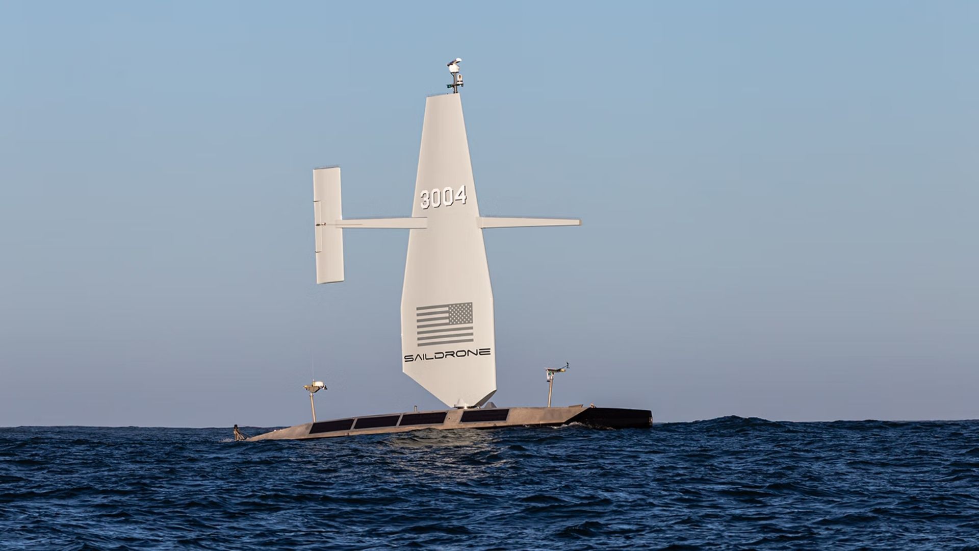
- Saildrone's Surveyor is a 66-foot uncrewed vessel of about 15 tons, with a 43-foot wing in carbon-fiber and fiberglass composites over a marine-grade aluminum hull.
- The resulting data is meant to support safe navigation, submarine missions, anti-submarine warfare, critical infrastructure protection, rescue operations and vessel route planning.
- Only 28.7 percent of the world's oceans have been mapped to modern standards, with much of the rest known through lower-resolution estimates that may miss hazards, according to the report on the award.
Compiled by The Product DeskSomething wrong?How this is made
Why it matters
- decision Survey planning now splits area by area: where a specialist aboard only speeds up the same lines, the 100-day hull takes the tasking and the crewed ship goes somewhere that needs a human reading the sonar.
- constraint An 80-horsepower diesel generator keeps the vessel working when winds are weak, so a wind-driven survey schedule still depends on fuel aboard and the logistics chain behind it.
- exposure The same modular hull can carry radar, satellite communications, infrared cameras and machine-learning threat detection, so a hydrographic platform loitering in international waters is also an ISR-capable one.
- precedent Saildrone says this extends government mapping work it started in 2019. That points to a multi-year uncrewed survey line item as the expected answer for remote areas in the next round of taskings.
The Surveyor can stay at sea for as much as 100 days and does up to 6 knots, or roughly 7 miles per hour [6][7]. Multiply that out and 100 days of steaming comes to 14,400 nautical miles [1]. Saildrone gives the range as more than 2,500 nautical miles [8]. Across a full deployment that is 25 nautical miles a day, an average of about one knot [2]. Those two figures are not measuring the same thing. Interesting Engineering's account of the award leaves out the Surveyor count and the area of seabed the $10 million covers.
The award pays for roughly two years of field work, about $5 million a year [4]. What it buys is depth data, and the same survey lines serve two customers: seafloor terrain influences acoustic propagation and maneuvering, so the bathymetry supports submarine and anti-submarine operations as well as charts [15]. The Surveyor also measures currents down to about 3,280 feet, which search-and-recovery teams use to estimate how people or debris drift after entering the water [16].
"High-resolution ocean mapping is vital to the US Navy's maritime superiority and strategic advantage, enabling safe navigation, effective submarine operations, and fleet lethality," said Kitch Kennedy, senior director of ocean mapping at Saildrone [13].
The substitution is partial by design. The Navy has gathered seabed data with crewed survey ships and oceanographic specialists aboard, and the case for long-endurance uncrewed hulls is that they cover large remote areas so those crews can concentrate on regions needing direct human expertise [12].
The 28.7 percent is a global number, and the other 71.3 percent of the ocean has no map to modern standards [3]. This contract covers parts of the Atlantic [1].
For anyone weighing an uncrewed platform against a crewed one, the test runs per survey area: whether a person aboard changes the data, or only the calendar. If a specialist aboard means the same lines get run sooner, endurance wins on cost. If the specialist changes the data itself, repairing a sonar mid-line or deciding on the spot to re-run an anomaly, the crewed ship still sails. In 2027 the measure of this award is how much Atlantic seabed reaches modern-standard charts.
What to watch
- A follow-on award or option exercise after 2027, and whether it is priced per square kilometre surveyed instead of per contract.
- Whether crewed survey ship taskings in the Atlantic drop as Surveyor deployments accumulate.
- Whether the radar and threat-detection payload options show up in a separate Navy award rather than a hydrographic one.