Product1 distinct publisher2 min readPublished
Honeywell's sensor read the Earth's crust well enough to navigate an Embraer 170 home over open water, and the notable part is how little of the aircraft had to change. A civil version has no date yet.
The Product Desk · Product desk

Compiled by The Product DeskSomething wrong?How this is made
The crew read their position off a tablet [4]. That is the sentence with operational consequences in it: the Defense Innovation Unit's account says streaming to commercially available displays suggests adoption needs less aircraft modification than more complicated navigation systems [15]. The pitch is quantum sensing; the thing flown was a magnetometer plus a crustal map, rendered on hardware already in the cockpit bag.
The 89 percent needs a denominator. DIU compared its result against conventional backup navigation methods [3], a category the same account describes as radar returns and visual landmarks that thin out over remote areas, along with onboard sensors that accumulate error the longer they run [9]. Beating that by 89 percent leaves 11 percent of whatever error the baseline had [13], and the baseline value is not on the record, so the figure does not convert into nautical miles. The leg ran 263 minutes [12], which is a long time for anything drift-based to hold up in a comparison.
Position comes from continuously matching measured magnetic signatures against a map of Earth's crust [8], which puts survey coverage and resolution alongside the sensor as a dependency. The demonstrated route was a Puget Sound to southern Alaska corridor and back [2], exactly the kind of water where radar and ground features are least useful [9]. Field strength is also the part of this an adversary cannot switch off the way satellite signals can be jammed [10], which is why the money is there.
Kyle Norman, deputy director of DIU's Kill Web portfolio, said MagNav capabilities are no longer a distant research goal and that the office moved from problem sourcing to solicitation to prototype in a matter of months [7]. Honeywell was one applicant in 72, about 1.4 percent of the field [5][14]. For everyone else, the report offers an eventual backup for civil aviation as GPS interference grows, with no date and no certification path attached [11].
Two questions sort this for an operator. The first is install depth: an advisory display the crew reads, or a certified position source wired into the flight management system. The second is whether the airspace you fly sits inside a surveyed magnetic map. This test answers the easy quadrant, an advisory display over a mapped corridor flown by a program office that owns both ends of the problem. A retrofit line item needs the other three quadrants answered, plus an absolute error figure to write in the box.
Ranked by verification strength, evidence, and original report placement.
Unlike satellite navigation, Earth's magnetic field cannot simply be switched off or blocked by an adversary.
A flight test under the US Defense Innovation Unit's MagNav program demonstrated that aircraft can navigate over the open ocean without relying on GPS, using quantum sensors to read subtle variations in Earth's magnetic field.
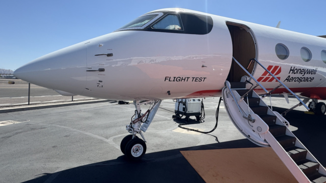
An Embraer 170 flew for 4 hours and 23 minutes over the Pacific Ocean, from Seattle's Puget Sound to southern Alaska and back, while operating without GPS.
The system provided navigation data to pilots in real time through standard, commercially available tablets.
MagNav began in 2024 under the Transition of Quantum Sensing initiative; DIU received 72 applications before selecting Honeywell Aerospace to develop the prototype.
DIU and Honeywell plan another demonstration aboard a US Air Force C-17 Globemaster III later this year, which DIU describes as a more operationally relevant environment.
Distinct publishers with included, body-backed reporting in this cluster.
1 article · September 6, 2026
Follow any of these and your For You feed starts watching them — no settings page required.
product
Q-CTRL's gravity sensor navigated the Coral Sea without a satellite fix1 distinct publisher
product
Wildfire tells you less about General Atomics than about what DIU is buying1 distinct publisher
product
The Air Force just published its shopping list of threat signatures it wants to shoot at cheaply1 distinct publisher
product
The Air Force's JASSM bet: a second engine source beats a better engine1 distinct publisher
Evidence-backed comparisons of source perspectives and observed adoption signals. Read the methodology
Which Builder, Operator, and Investor concerns the observed source mix emphasized—not a truth score.
Evidence, demonstrated adoption, hype gap, incentives, and confidence are assessed independently, each on its own current evidence. How these are measured.
One outlet, the program's own figures
Every number in this story reaches us the same way: Interesting Engineering relaying the Defense Innovation Unit. The route and the 4 hour 23 minute duration are specific enough to be checkable, but the flight has no date, the 89 percent has no units and no named baseline, and the primary DIU release is not in our coverage to compare against.
One prototype, one airframe
A single sensor flew once on a regional jet, with a military transport flight promised for later in the year. The tablet display hints at a light installation footprint, but there is no fielding, no order, no second operator and nothing on the civil side.
Headline outruns the test
"US military nails GPS-free navigation" is heavy freight for one four-hour prototype flight, and the 89 percent gain is a ratio dressed as a result. Norman's own wording is more careful than the headline: capabilities are no longer a distant research goal, which is not a claim that they are ready.
Funder and vendor, no third voice
The quotation comes from the deputy director of the portfolio that paid for the work, the accuracy number from the programme that selected the vendor, and no independent measurement appears anywhere in the piece. That does not make it wrong; it does mean both parties with a next-phase demonstration to justify are the only ones talking.
Solid enough to report, not to rely on
That the flight happened, on that route, for that long, is straightforward to accept. How well it navigated is not, because the one figure quantifying it is unanchored and no second account exists to check it.