Science1 publisher2 min readPublished
A gravimeter hauled up Mount Timpanogos mapped 1.55 million cubic meters of buried ice
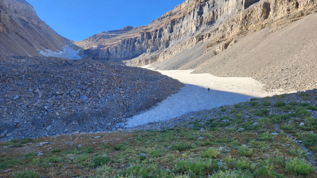
Ground-penetrating radar cannot always find bedrock beneath a rock glacier's rubble, so a University of Utah team measured gravity across the ice instead and turned the result into a rule linking surface area to ice volume.
The Scientist · Science desk
What happened
- Timpanogos Glacier, a rock glacier buried under fallen rock on Utah's Mount Timpanogos, holds 1,550,000 cubic meters of ice, according to a new study in the Journal of Geophysical Research: Earth Surface.
- Ground-penetrating radar cannot always get through the rock layer covering such a glacier to find the bedrock underneath, which leaves the ice thickness unresolved by the standard method.
- Michael Thorne, a University of Utah seismologist, hit on the idea of using a gravimeter instead while teaching an undergraduate geology lab class.
- Master's student Bronson Cvijanovich carried the gravimeter up a 5-mile high-elevation trail, collecting 232 measurements over six multiday trips to the glacier.
Compiled by The ScientistSomething wrong?How this is made
Why it matters
- capability Ice volumes that radar could not reach are now measurable with an instrument one person can carry up a trail, and a technique glaciology set aside once GPR arrived is back in service.
- constraint Six multiday trips bought one glacier's worth of data, so nobody is going to survey a state this way; any regional inventory has to lean on the area-to-volume relationship instead.
- decision Anyone quoting the 13-cubic-kilometer figure for the western United States is quoting an extrapolation from mapped surface areas, and has to judge whether that is firm enough to carry into a water accounting.
The measurement rests on a density contrast. Ice is less dense than the bedrock beneath it, and a gravimeter picks up the tiny difference in gravitational pull that results, which is what lets it distinguish rock from ice underground [9]. "As we get to areas where the ice is thicker and thicker, the gravitational acceleration is just lower and lower," Thorne said [10].
The idea is not new. Gravimeters were used on glaciers before ground-penetrating radar arrived, then fell out of favor [11]. Leif Andersson, a glaciologist at the University of Utah and a coauthor, said modern instruments resolve "really small deviations in the gravitational field" [12]. "The reason why the study was possible was the technology," he said [13].
Thorne framed the project as a methods question: "Part of our motivation has been, well, 'Can we come up with techniques for imaging the interior of these rock glaciers that don't only rely on ground-penetrating radar?'" [7]. The 232 readings were fitted with a Bayesian inversion, which compares thousands of simulated distributions of subsurface ice against the measurements and scores how well each one fits [15].
The transferable output is a relationship the team derived between a rock glacier's surface area and the typical ice volume beneath it, built from Timpanogos plus some measurements of other rock glaciers [16]. Timpanogos holds 1,550,000 cubic meters of ice, which is 0.00155 cubic kilometer, against the 1.08 cubic kilometers the team assigns to Utah's rock glaciers as a group: about 0.14 percent of the state total [22]. The larger figures come from the same relationship, with the western United States at up to 13 cubic kilometers, roughly a quarter of the 52.38 cubic kilometers credited to all known rock glaciers on Earth [17][23]. The Eos account does not report how many other rock glaciers went into the relationship, or the uncertainty on those totals [21].
A gravity survey resolves where mass sits at the moment of measurement [9]. Melt rate and whether that water reaches a stream are separate measurements, so these numbers are a stock estimate and not a yield forecast.
Doug Clark, a geologist at Western Washington University who researches rock glaciers in the western United States and New Zealand and was not involved in the work, called it "an elegant approach to address one of the more vexing problems regarding rock glaciers: What is the internal ice content of these things?" [18][19]. He said the modeling and the use of the gravimeter marked a "significant improvement over past efforts of estimating ice volume" in rock glaciers [20].
What to watch
- Publication of uncertainty bounds and the number of calibration sites behind the surface-area-to-ice-volume relationship.
- Whether other groups run gravimeter surveys on rock glaciers where GPR did reach bedrock, which would give the method an independent cross-check.
- Whether any Utah or western United States water accounting starts carrying a rock glacier ice figure at all.