Science1 publisher2 min readPublished
Ground imaging traces the Nullarbor's mystery trenches to collapsed cave roofs
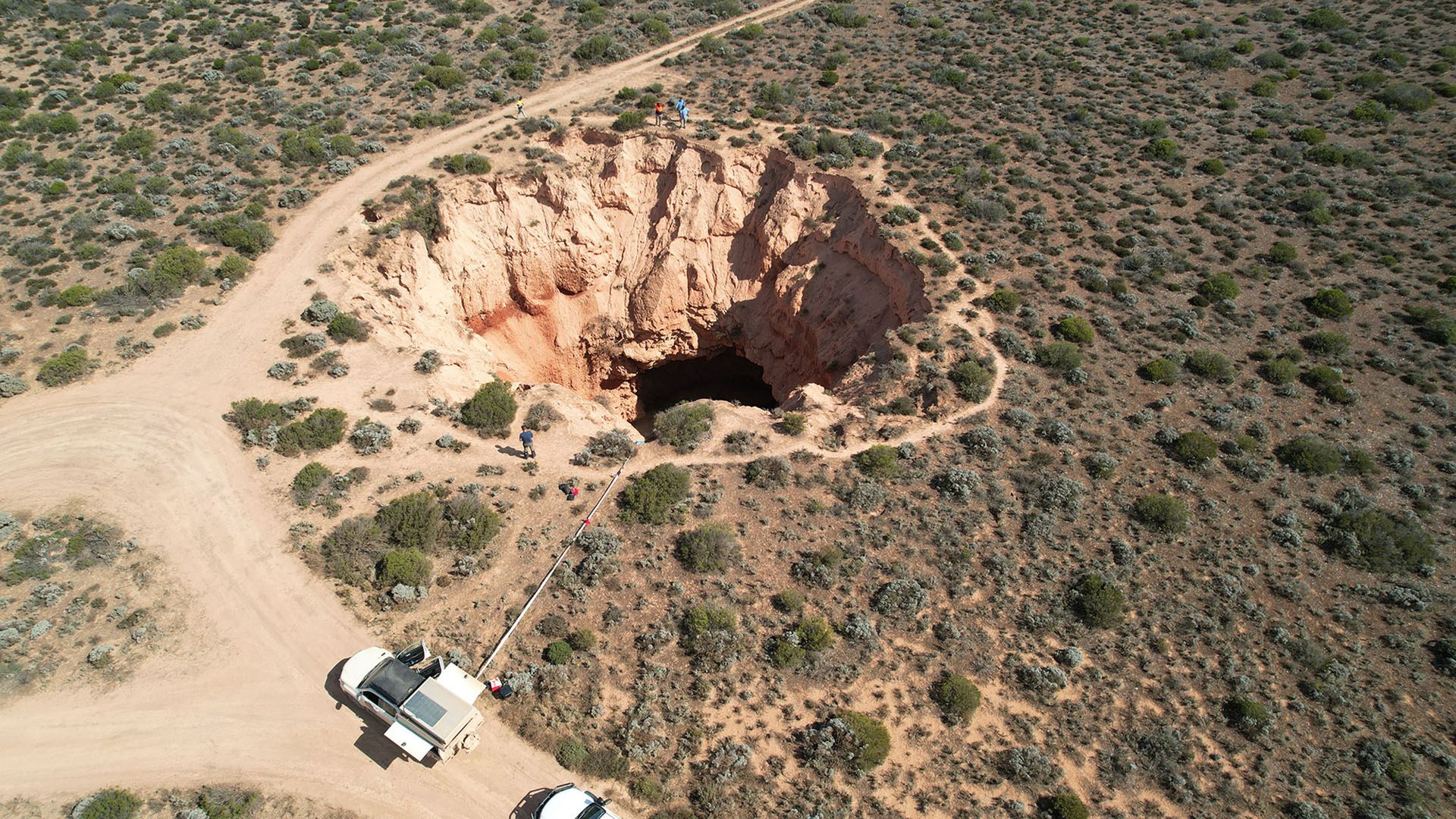
Matej Lipar's team ran resistivity lines across five linear depressions on the eastern Nullarbor Plain, found sediment-filled canyons more than 40 meters deep beneath them, and then climbed into a cave through a sinkhole in one trench to check.
The Scientist · Science desk
What happened
- Five long trenches with similar north-to-south orientations run along the eastern edge of Australia's Nullarbor Plain, a flat and almost treeless expanse in the country's south.
- Electrical resistivity profiles showed each depression capping a canyon-like form filled with sediment, sand in the upper layers and higher proportions of silt and clay deeper down.
- A search of a cave database found big, deep caves aligned along the trenches, some reachable through sinkholes and containing passages that stretch for hundreds of metres.
- The team entered Clay Dam Cave through a sinkhole inside one trench and found sagging strata and sandy infill matching what the imaging had shown under the other trenches.
- The study was published Sept. 17 in Communications Earth and Environment. It records trench lengths from several miles to more than 20 kilometers and widths of 100 to 500 meters.
Compiled by The ScientistSomething wrong?How this is made
Why it matters
- capability Lipar says an unbroken cave may still sit where a trench stops. Cavers can test that by digging at the ends of the trenches.
- exposure Lipar infers from the fragmented trenches that the collapse is still under way. That makes ground along the eastern margin a working subsidence setting for anyone routing a road or a pipeline across it.
- constraint A collapse date and a measured subsidence rate are both missing, so whether the sagging is slow and steady or arrives in pulses remains unknown. A hazard estimate would need that distinction.
- precedent Zerboni's point about elongated depressions in the Arabian Peninsula gives the method somewhere to go next: a terrestrial test case for reading linear surface dips as collapsed karst rather than dry channels.
Unlike typical valleys, the trenches have no connected streams and nothing else to show that water once flowed through them [8]. Lipar said there is no evidence the wind cut them either [7]. "They look like some kind of river channel, but they start and end so abruptly that it triggered us to investigate them," said Matej Lipar of the Anton Melik Geographical Institute in Slovenia [3][2]. He is the study's first author.
The trenches are only 1 to 9 meters deep [5]. Shallow relief on a flat plain is hard to work with in the field, so the team started with digital terrain models exaggerated in the vertical. That made the depressions legible and showed where to put instruments [9]. Then came electrical resistivity tomography, which measures how electrical currents flow through the ground and separates rock from sediment [10]. The profiles put each trench at the top of a canyon-like form reaching more than 40 meters down [11].
Against more than 40 meters of fill, 9 meters of surface relief is about a fifth, and 1 meter is a fortieth [1]. "Over time, the cave roofs progressively collapsed, causing sagging of overlying material, eventually creating these shallow depressions at the surface," Lipar said [14].
Lipar attributes the caves themselves to groundwater draining toward the coast through porous karst limestone. The dissolution ran through the Oligocene, 33.9 million to 23 million years ago, and the Early Miocene, 23 million to 16 million years ago [13]. The plain has existed for more than 14 million years [6]. If dissolution ended with that Early Miocene interval, the roofs have had at least 16 million years to give way [2].
Andrea Zerboni, an Earth scientist at the University of Milan, was not involved in the work. Zerboni told Live Science that "the authors skillfully show that the linear depressions along the margin of the Nullarbor Plain are probably the surface expression of the progressive collapse of ancient underground cavities" [18]. The case is a match of geometry against geometry, imaged fill lining up with catalogued caves, confirmed on the ground in the one cave the team could walk into.
Maximilian Dröllner, a geoscientist at the University of Göttingen, was also not involved. Dröllner told Live Science the work "could help identify similar caves elsewhere and may be particularly valuable for the study of caves and potentially habitable environments on other planetary bodies" [20].
What to watch
- A chronology for the collapses, from dating the sediment fill or the sagged strata, would show whether the sagging is steady or episodic.
- Whether resistivity lines or drilling beyond the ends of the trenches find the intact voids the study predicts are still there.
- Whether the same imaging plus cave-database method is applied to the elongated depressions in the Arabian Peninsula.