Science1 publisher2 min readPublished
Geophysics traces the Nullarbor's faint surface trenches to caves collapsing upward
Drones, satellite elevation models, boreholes and geophysical profiles put zones of broken rock beneath trenches up to 20 kilometres long, and the authors say the same signature could find caves on other planets.
The Scientist · Science desk
What happened
- A study in Communications Earth & Environment maps shallow trenches across the Nullarbor Plain that run up to 20 kilometres, sit only a few metres below the surrounding surface and trend roughly north-south.
- Rivers were ruled out: the trenches begin and end abruptly, connect to no drainage network, lack the branching of river valleys, and their sediments show no evidence of deposition by flowing water.
- The team combined drone and aerial photography, satellite-based digital landscape models, borehole and in-cave measurement of soil and rock layers, and specialised geophysical imaging of the subsurface.
- Beneath the trenches the surveys found deep zones of broken rock, and in places the trenches sit over known caves and sinkholes; the authors interpret them as buried cave systems collapsing upward.
Compiled by The ScientistSomething wrong?How this is made
Why it matters
- capability Karst cave mapping has been limited to places where a cave breaks the surface. A detectable surface sag extends the search to ground with no opening at all.
- constraint Reproducing this off Earth means reproducing the calibration, and an orbital elevation model cannot be checked against a borehole log or a walked-through cave.
- decision Engineers siting roads, tunnels and sewers on limestone, and agencies protecting groundwater, now have a reason to treat a faint shallow trench as a void indicator before they drill.
- precedent If a metres-deep surface feature can signal a cave system far below it, unexplained shallow valleys in other karst regions become candidates for re-interpretation.
A void opens in limestone at depth, out of sight. The rock above it fractures and settles into the space, and that disturbance migrates upward through the overlying layers over millions of years until the surface itself sags [13]. The features barely register on foot, and they show up clearly in a modern digital landscape model [8]. Take "a few metres" as five and a 20-kilometre trench has a length-to-depth ratio of about 4,000 to 1 [22].
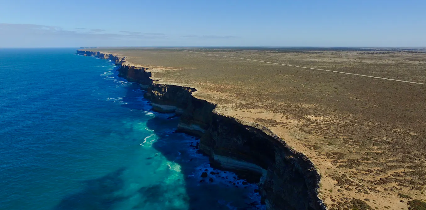
The setting helps: the plain covers more than 200,000 square kilometres of limestone, left behind when a shallow sea retreated about 14 million years ago [1][2]. Victorian-era colonial explorers described it as "the sort of place one gets into in bad dreams" [3]. The Mirning People of the Nullarbor and the Great Australian Bight have lived on this southern margin for tens of thousands of years, through the sea-level fall and rise that came with the buildup and collapse of the last ice age about 20,000 years ago [4].
The authors write that their work "provides a new way to identify hidden caves elsewhere", and that this holds "even beyond our own planet" [14]. The Earth-side version of that claim stands on its own data. The off-planet extension is an inference the account states in a single sentence, and the reason the Nullarbor version works is local: the caves there are known and accessible where they breach the surface [6]. That access is what let boreholes and in-cave measurements calibrate what the elevation data was showing [11]. They also say the results "will change how scientists interpret cave landscapes globally" [20].
The stakes on Earth are unglamorous and large. Karst covers 15% of the ice-free land surface and supplies water to between 10% and 25% of the global population [16]. The upper end of that water figure is about 1.7 times the land share; the lower end is about two-thirds of it [17].
Caves are sheltered from surface weathering and erosion, so they hold snapshots of ancient environments and ecosystems that are gone above ground [18]. They may also hold life that evolved and adapted in isolation, among the least studied organisms on Earth [19]. "To learn more, we must first locate the cave structures," the authors write [23].
What to watch
- Whether the trench-to-void relationship holds in a second karst region where drilling can independently confirm buried cavities.
- Whether the borehole logs and geophysical profiles are released so other groups can test the interpretation.
- Any attempt to look for the same shallow, abruptly ending trench pattern in high-resolution Martian or lunar elevation data.