Science1 publisher2 min readPublished
Wollongong researchers scale Antarctic moss maps from ground surveys up to satellites
University of Wollongong researchers spent seven years building an AI pipeline that passes field and drone data up to satellites to map Antarctic moss. Whether its satellite layer holds up beyond the well-vegetated glacier where it was tested will decide if it can monitor the wider continent.
The Scientist · Science desk
What happened
- Antarctic mosses, lichens and cyanobacteria grow in small, scattered patches that are easy to study on foot but hard to monitor across a whole landscape.
- The researchers say they can now, for the first time, make long-term maps that span scales from granular moss patches to large stretches of landscape.
- The study is published in the ISPRS Journal of Photogrammetry and Remote Sensing.
Compiled by The ScientistSomething wrong?How this is made
Why it matters
- capability A few seasons of costly fieldwork could be stretched, through repeat satellite passes, across ice-free ground that teams find difficult and expensive to revisit.
- constraint Because each layer learns from the one beneath it, any mislabelling in the drone maps is carried into the satellite maps built from them.
- decision Groups that want these maps for biodiversity models or management plans will need to check the paper's own validation before relying on satellite-scale estimates.
"We can observe this ecological detail in the field and with drones, but these approaches cover relatively small areas. Satellites, on the other hand, can repeatedly observe much larger landscapes, but at a much coarser spatial scale," said Narmilan Amarasingam, the study's lead author [4]. The obstacle is pixel size: a moss patch a few centimetres across takes up only a small part of a coarse satellite pixel [6].
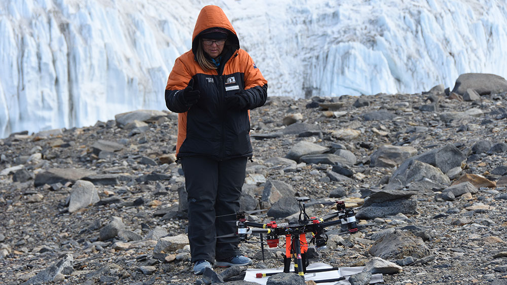
The team's answer is a relay. "Our idea was to connect these different scales, using detailed field observations to inform drone-based mapping, and then using those drone-derived observations to support satellite-scale monitoring," Amarasingam said [12]. Each layer supplies the training labels for the one above it. The design suits a place where ground truth is costly, because the sites are difficult, expensive and logistically challenging to revisit [13]. A person labels a small area, drone imagery extends those labels across a site, and the satellite comes back to that site year after year [4].
The framework was built and tested over seven years at Canada Glacier [5], and that span gives it a second axis. A record that long is what lets researchers tell a single odd season from a longer-term change as Antarctica warms [10].
The press release does not report classification accuracy, the resolution of the satellite imagery, or how closely satellite-scale estimates agree with the drone and field data. Those figures matter more than usual for a relay design. A drone map that labels a lichen patch as bare rock hands that mistake to the satellite model trained on it [12].
The other limit is the site itself: Canada Glacier sits in an ice-free polar desert with some of the most biologically productive vegetation in Antarctica [5]. I think that makes it the right place to develop a method and the easiest place to test one, since dense vegetation gives the models the strongest signal to learn from. The harder case for continent-wide monitoring is a site with sparser, smaller patches, where the satellite layer has to run without fresh drone flights underneath it.
The researchers do not pitch the framework as a substitute for fieldwork. "The aim is not to replace fieldwork. Field observations remain essential because they provide the biological understanding needed to interpret what we see remotely," Amarasingam said [9]. The team, from the Australian Research Council's Securing Antarctica's Environmental Future program, says the framework could supply large-scale data for decision-making, biodiversity modelling and environmental management [2][7].
What to watch
- Accuracy figures in the full ISPRS paper showing how closely the satellite-scale maps match drone and field data at Canada Glacier.
- Whether the framework is run at other ice-free Antarctic sites with sparser vegetation and no fresh drone flights.
- Whether the maps are used in biodiversity models or protection decisions for Antarctica, as the SAEF team proposes.