Science1 publisher3 min readPublished
Thermal cameras on a Dutch offshore turbine flag 22 possible bird collisions in a year
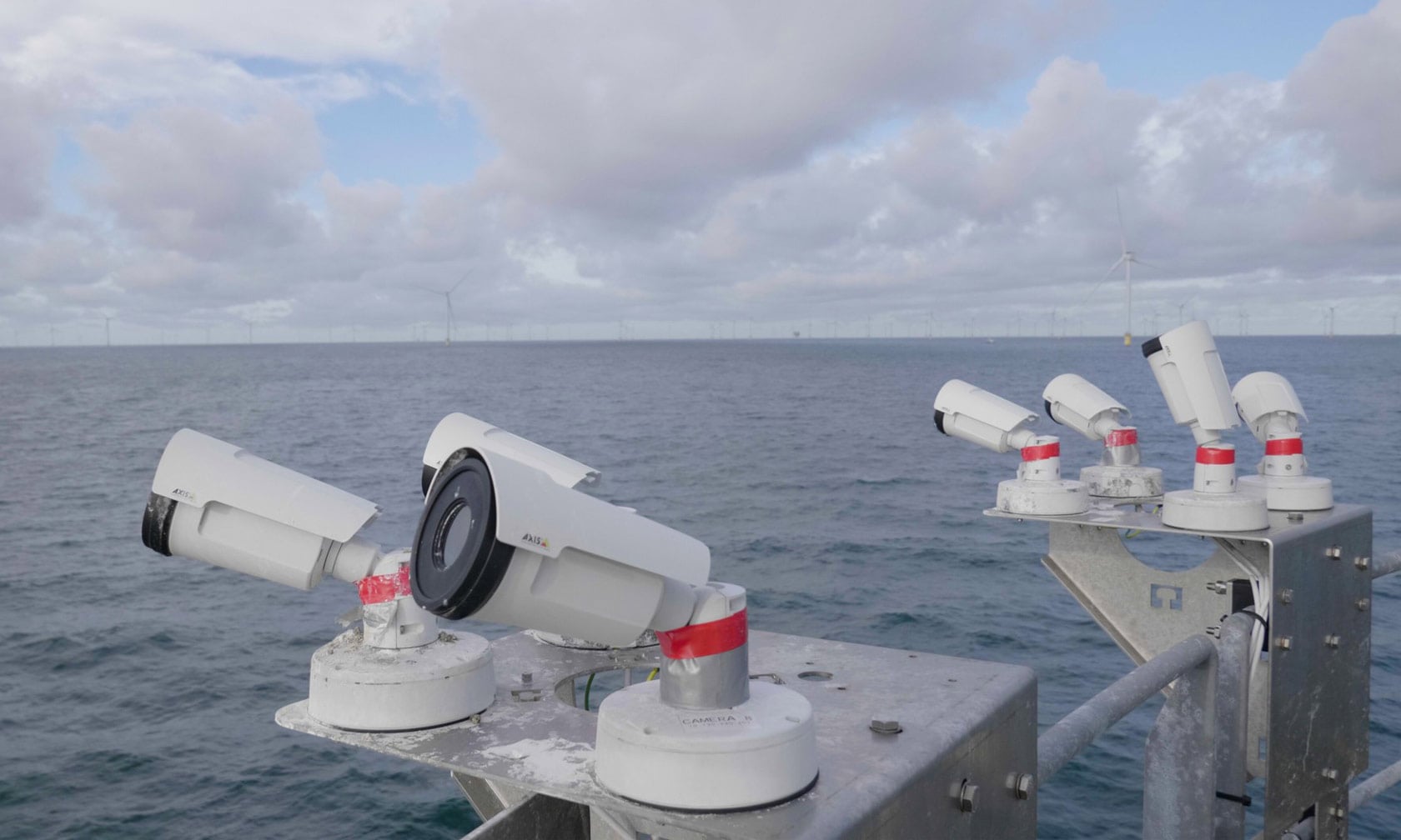
Vattenfall's pilot with 16 thermal cameras on one Dutch offshore turbine flagged 22 possible bird collisions in a year, two of them confirmed. It shows offshore strikes can be counted directly, though one turbine without a reported miss rate cannot yet give a collision rate.
The Scientist · Science desk
What happened
- The pilot ran at the Hollandse Kust Zuid offshore wind farm, with Wildlife Imaging Systems building the camera system and Wageningen University & Research analysing it.
- AI software paired with the cameras detected and interpreted bird movements day and night, including in fog and rain.
- One more flagged event was rated highly probable, and the monitoring year took in both a spring and a fall migration season.
Compiled by The ScientistSomething wrong?How this is made
Why it matters
- capability Operators get measured offshore collision counts to test model-based estimates against, in waters where no carcasses can be recovered to verify deaths.
- constraint With only 3 of 22 flagged events confirmed or rated highly probable, any collision figure built on this system depends heavily on how the uncertain 19 get resolved.
- decision Developers and regulators who want to swap modelled estimates for measured counts need the multi-site results first, because one turbine's year does not transfer to other farms.
Only three of the 22 flagged events got past "possible": two confirmed collisions and one rated highly probable [7]. That is about 14 percent [1]. The other 19 stayed in the possible column [2].
The camera design follows from when the birds move. Millions of songbirds cross the North Sea on spring and fall migration, mostly at night [8]. Thermal imaging picks up small birds and bats in darkness and larger birds by day [9]. Wildlife Imaging Systems mounted 16 of those cameras on a single turbine to cover every angle, running 24 hours a day [3]. The AI software kept detecting and interpreting movements through fog and rain [4].
Direct counts matter because offshore there has been little else to go on. "Until now, estimates of offshore bird collisions were mainly based on theoretical models," Jesper Kyed Larsen, a bioscience expert at Vattenfall, said [10]. "At sea, it is extremely difficult to verify fatalities because there are no remains to recover," he said [11]. Karen Krijgsveld, a bird ecology researcher at Wageningen University & Research, compared this with the situation on land: "On land, we already know quite a lot about when and why birds collide with turbines, and which species are most at risk," she said [6].
Larsen's point about missing remains also limits the pilot. With no bodies to recover, there is no second tally at sea to check the camera count against [11]. The thing this doesn't tell you is how many collisions the cameras missed, or what the 19 unconfirmed events turned out to be. A collision rate per bird or per turbine would need that miss rate as well as the flagged events from this one machine [7].
The researchers do not overclaim. Wageningen researchers analysed the data to judge how the system performed and where it could improve [5], in a report led by Krijgsveld [15]. According to the account of that work, the study does not claim collisions are rare or that one turbine's results apply everywhere, and its primary aim was to test the technology under real offshore conditions [12]. Krijgsveld's own claim is about capability. "We now have a system that can measure bird and bat collisions offshore, and we can start to measure collisions and relate their occurrence to the local conditions," she said [13].
Larsen described the value as "the empirical data needed to improve collision estimates and secure efficient mitigation measures" [16]. I think the evidence supports that narrower conclusion today: a counting method that works at sea and produces real data on bird movements around a turbine [1]. Changing how developers and regulators weigh wildlife risk would take collision rates across many sites. The next phase will collect collision data across different conditions and locations while fine-tuning the monitoring technology [14].
What to watch
- Whether the multi-site phase publishes a detection or miss rate for the camera system, the figure needed to turn flags into a collision rate.
- How the 19 unconfirmed events are classified in the full WUR report or in later analyses.
- Whether later data ties collisions to specific local conditions such as weather or heavy migration nights, as Krijgsveld says the system now allows.