Science1 publisher3 min readPublished
A global survey finds steady rain-to-runoff behavior on 1.5% of the land area studied
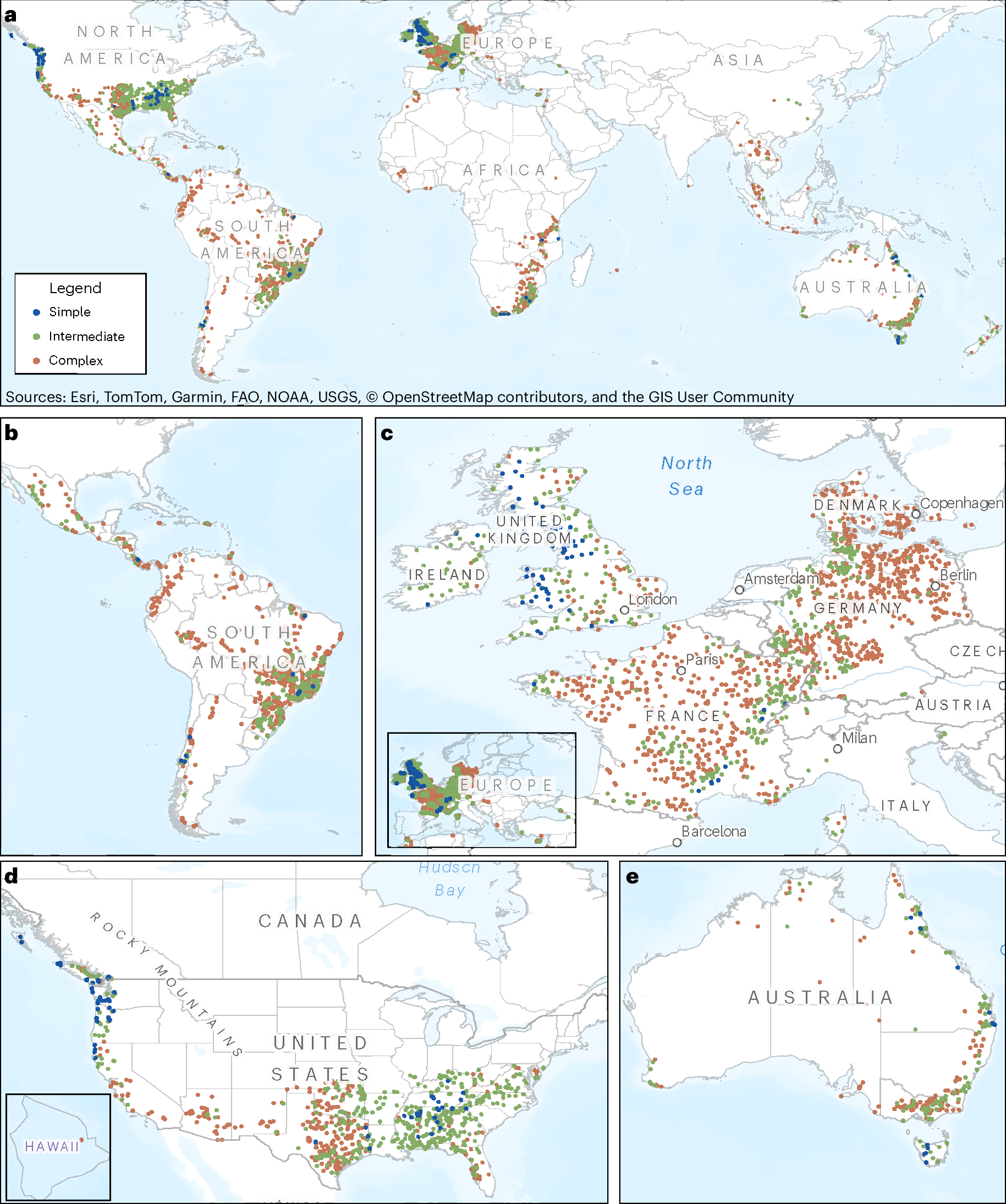
A Nature Water team used more than 2 million rainfall-runoff events to classify more than 80,000 catchments, and found that on 87% of the land area evaluated the same rainfall can deliver very different flow.
The Scientist · Science desk
What happened
- A Nature Water team classified more than 80,000 catchments across 97 countries using more than 2 million rainfall-runoff events, scoring how consistently each turns a given amount of rain into river flow.
- Catchments where similar rainfall can produce very different runoff covered 87% of the land area evaluated, about 121 million square kilometers.
- Catchments that deliver roughly the same amount of water to the river every time covered 1.5%, and an intermediate group switches between two or three stable ways of responding.
- The strongest separator was how often meaningful rainfall arrives, with the consistent catchments concentrated in wetter, more humid regions and the complex ones in drier settings.
Compiled by The ScientistSomething wrong?How this is made
Why it matters
- constraint Fitting one rain-to-runoff ratio per catchment holds up on the 1.5% of land where the response repeats; over the 87%, the relationship has to be conditioned on how wet the ground already is before the storm.
- capability An engineer can now look up which class a specific basin falls into before deciding how to calibrate a model for it, using a free tool rather than a literature search.
- exposure Design-flood and water-yield estimates across Africa, much of Asia and most of South America rest on catchments in the complex class, so a single event-to-runoff ratio carries more uncertainty there than the same method applied in coastal British Columbia.
- decision Where rainfall is intermittent, antecedent soil moisture becomes a variable worth instrumenting, and the rainfall-frequency ranking indicates which catchments would gain most from that spending.
What the team measured is consistency. Across more than 2 million rainfall-runoff events in more than 80,000 catchments in 97 countries, they asked one narrow question: does a given amount of rain deliver about the same amount of water to the stream every time it falls [2]. Where the answer is no, the catchment is classed complex, and complex catchments covered 87% of the land area evaluated [3].
That 87% is a share of the area assessed, not of the planet's land. Complex catchments came to 121 million square kilometers [3], which puts the evaluated area near 139 million [20] and the 1.5% classed simple near 2.1 million square kilometers [4][21]. The intermediate class takes the remaining 11.5% [19]. Averaged over the sample, each catchment contributed about 25 events [22]. An intermediate catchment is one the team saw using two or three stable ways of responding [5]. That takes enough events to see each of them more than once.
Ali Ameli, the University of British Columbia hydrologist who led the study, said "We often imagine a catchment as a pipe" [13]. He put the alternative this way: "But most catchments behave more like dynamic systems with a memory. How much of today's rainfall becomes runoff and reaches the stream depends on both the conditions created by earlier weather and which parts of the landscape supply water to the river during the storm" [12].
The strongest single separator was how often meaningful rain arrives [10]. Where storms come regularly, soils, subsurface stores and the pathways connecting the landscape to the stream stay in similar states between events; where rain is intermittent, a storm landing on dry ground soaks in while a similar storm on wet ground sends a far larger share downstream [17]. "Persistent rain keeps the landscape in a more consistent state. When wet and dry conditions alternate, the same catchment can behave very differently from one event to the next," Ameli said [18].
Overall water availability set the wider pattern. Using an aridity index and the long-term balance between rainfall and the water lost to evaporation and plant uptake [14], the team found the consistent catchments in wetter and more humid conditions and the complex ones more often in drier places [15]. Climate was the dominant influence [16].
The phys.org account describes the work as a picture of how catchments behave, not where rivers are or how much water they carry [23]. A comparison of forecast error between the simple and complex classes is missing from it [24]. So the 87% is the area where a single fitted rain-to-runoff ratio is the weaker assumption, not a measurement of how far off a flood or water-supply model runs there. Ameli's own description also puts weight on which parts of a landscape are contributing during a storm, alongside the state left by earlier weather [12].
The interactive global map and the free web application, which returns a classification for any catchment boundary, are both publicly available [9].
What to watch
- Whether anyone quantifies how much forecast error the complex class causes in an operational flood model.
- Whether the classifications shift as gauge records lengthen in Africa and Asia, where complex behavior dominates.
- Whether the classes start appearing in model calibration reports and design-flood guidance.