Product1 publisher3 min readPublished
Earth Fire Alliance starts its 50-satellite wildfire watch with three spacecraft in orbit
Earth Fire Alliance launched the first three of 50 planned FireSat satellites on July 7, a fleet built only to find wildfires. Its promised scan of every point on Earth every 20 minutes depends on the other 47 reaching orbit.
The Product Desk · Product desk
Drafted by a language model from the sources cited here and checked against its claim ledger before publication. How we use AISend a correction
What happened
- FireSat's sensors can pick out a fire as small as 5 by 5 meters, about the heat of a beach bonfire.
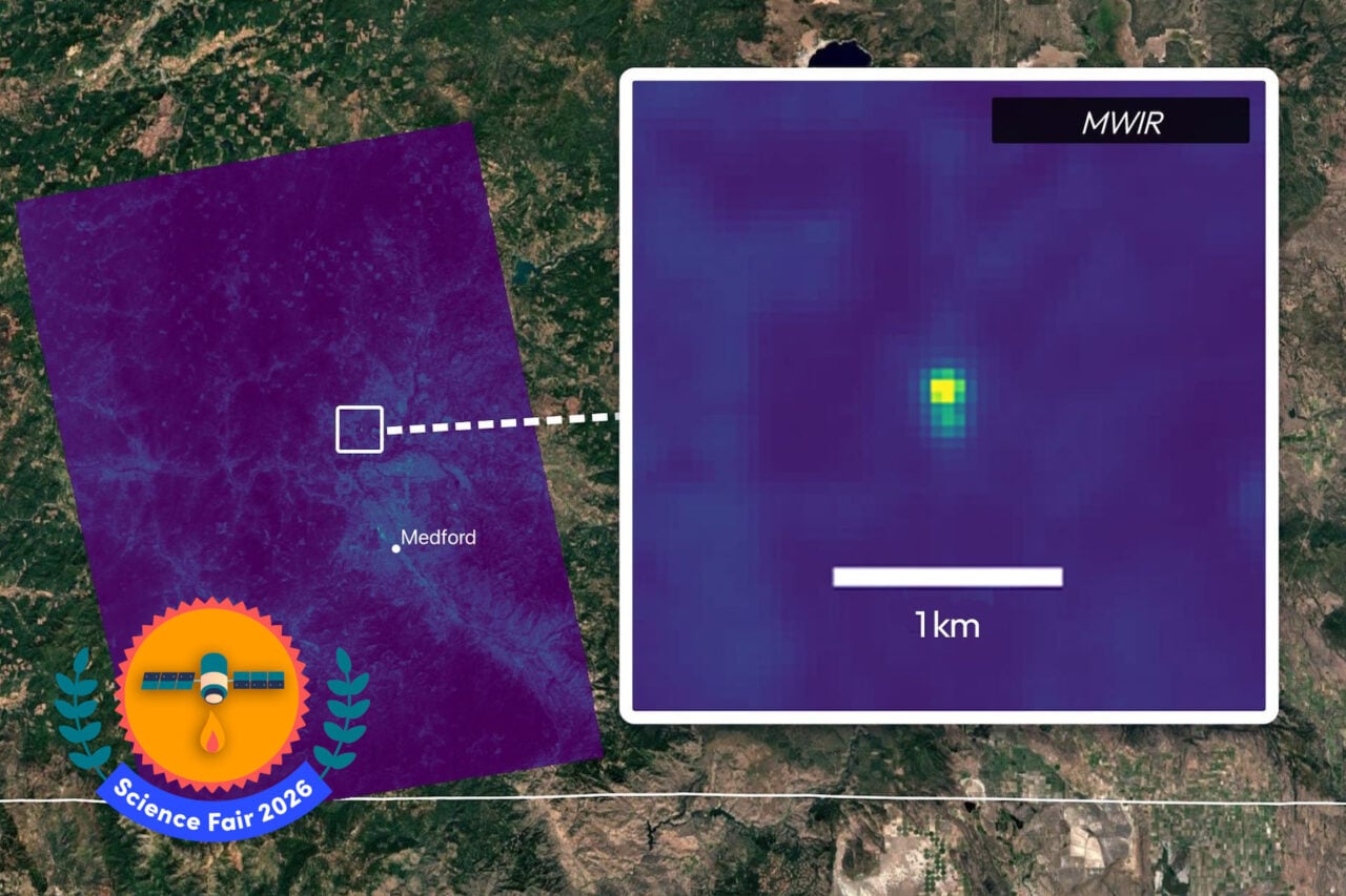
- A demonstration satellite launched in March 2025 spotted a small Oregon roadside fire in October that other space-based systems had missed.
- Muon Space builds and operates the satellites in partnership with Earth Fire Alliance, with funding from backers including the Bezos Earth Fund and Google.
Compiled by The Product DeskSomething wrong?How this is made
Why it matters
- capability A 5-by-5 meter detection threshold brings into view from orbit fires that responders now have to find with ground crews, aircraft or drones.
- constraint No agency can plan around a 20-minute look from orbit until the remaining 47 satellites fly, so each user has to measure for itself how often this season's feed revisits its area.
- decision Fire agencies now have to choose between logging FireSat alongside existing detection and changing dispatch rules on the strength of one demo-satellite catch.
- exposure Agencies that build dispatch around FireSat would depend on a single operator, Muon Space, and on a feed funded by philanthropic and corporate backers.
"It started when somebody was dragging trailer chains behind their truck on the highway," Michael Falkowski, Earth Fire Alliance's lead scientist, told Gizmodo, describing the Oregon roadside fire [9]. "We saw that in our data, and it just gave us evidence of FireSat's ability to get these cool, small fires before they become a problem." [10] That catch came from a single demonstration satellite. It is the article's evidence for the project's stated aim of finding small, cool ignitions before they escalate [8][16].
Fire responders who would act on a catch like that collect data three ways: ground detection, aircraft or drones, and weather satellites [15]. Jonny Dyer, chief executive of Muon Space, described the third [13]. "The problem with the current satellites is that they're very low resolution, so they typically only see a fire once it's gotten very large, and they only get updates maybe every 12 hours and sometimes 24 hours," he said [13]. "So if you're trying to make decisions on the ground, that's really limiting." [14]
Gizmodo describes FireSat as the first constellation designed specifically for wildfire detection [5]. With all 50 satellites in low-Earth orbit, it is designed to image every point on Earth every 20 minutes [3][4]. That is 36 to 72 times as often as the updates Dyer describes [1]. The three launched on July 7 make up 6% of the planned fleet [1][2]. The article does not say how often those three pass over a given area, what fire agencies will pay for the data, or how an alert reaches a dispatcher.
The example the article gives from after the launch is a different kind of fire. The Big Grass Fire had already burned 290,000 acres when the satellites recorded it [11]. Dyer says existing satellites already see fires once they are "very large" [13], and this one was. That detection does more for the project's second user, scientists building a global dataset on fire behavior [16], than for a dispatcher. FireSat records in six multispectral imaging bands [7].
Muon builds and operates the satellites in partnership with EFA [12]. "Our business model is, somebody comes to us with a problem, and then we will kind of work end-to-end to solve that problem with satellites," Dyer said [17]. This problem reached him through Google researchers working on wildfire detection [19]. He said they had found "this huge data gap around wildfires" [18]. EFA formed in 2024 with FireSat as its flagship project [2].
In my view an agency should run the FireSat feed alongside its existing detection this season and leave its dispatch rules alone until it has its own record. The tradeoff: analysts spend time on a three-satellite feed whose coverage the agency has to measure itself, and in return crews are not moved on the strength of one roadside fire [8].
The record I'd keep sorts each FireSat detection on two axes. The first is size, meaning smaller or larger than the fires weather satellites already catch [13]. The second is order, meaning before or after the agency's first report from ground crews, aircraft or drones [15]. FireSat was built for the small fire it reports first. The Oregon fire qualifies on size, since other satellites had missed it [8]. A small fire that FireSat reports second confirms what crews already knew. Large fires like Big Grass land in the half that helps mapping and research more than first response [11]. Each row needs two numbers: the fire's size when FireSat detected it, and the minutes between that detection and the agency's first report from any other source.
What to watch
- How fast EFA and Muon Space add satellites beyond the first three, since the 20-minute global revisit is tied to the full 50.
- Whether any fire agency publishes timing data comparing FireSat alerts with its first ground or aircraft reports this fire season.
- Published terms for how responders receive FireSat alerts and what, if anything, they pay for them.